National Flight Following 168.650

Status
Not open for further replies.

SCPD

QRT
Joined
Feb 24, 2001
Messages
0
Location
Virginia
This frequency (168.650) was designated as "National Flight Following" sometime in the late 1990's. The first listing of it I have is in a U.S. Forest Service frequency directory dated May 2000. I would like to know if anyone has been monitoring this frequency in their local area, and what they may have heard.

All aircraft being used by the U.S. Forest Service, National Park Service, BLM, BIA, and Fish and Wildlife Service are required to establish "flight following", which means those aircraft must make contact with a dispatch center every 20 minutes while in the air. When working on initial attack or a large incident this flight following is generally done with personnel on the incident itself. When helicopters, reconnaissance, tankers, leads or air attack aircraft are flying from their bases to incidents on other jurisdictions they have to flight follow with whatever dispatch center they can establish radio contact with. Many years ago this was done on what is now designated "National Air Guard" on 168.625, when it was known as "National Air Net." With the use of Air Guard become restricted to emergencies and initial calling only, aircraft had to dial up the local jurisdictions frequency. When flying over entire states this required quite a bit of work. To alleviate the need to change frequencies so often, National Flight Following was established with a frequency of 168.650. Wildland agencies were supposed to provide base stations, or in most cases, remote base stations on a nearby peak or mountain, for National Flight Following.

I have 168.650 programmed in my scanner but don't hear anything on it locally. I would like to hear from folks located in other parts of the country who hear traffic on this frequency, especially if they hear the remote base of the nearest wildland fire dispatch center on this frequency. I'm trying to get some sense of how widespread, and at what stage, the implementation of this system is.
 

CCHLLM

Member
Joined
May 10, 2003
Messages
1,020
I hear it occasionally here in NC during times when there's a good deal of inter-forest (Croatan, Nantahala, Pisgah, Uwharrie NF) flight dispatch activity due to fire situations, but most of the time it's pretty dead. When you do hear traffic, it's during the period that the aircraft is in transit from base or wherever to the assigned area, not during it's actual fire fighting ops. Being in the NW part of NC, I mostly hear Pisgah NF and Uwharrie NF flight traffic and it's mostly helos. I've also occasionally heard aircraft check in on the main channels of the various NF when there's no fire activity and they're apparently passing through shuttling to another forest for whatever reason.
 
Last edited:

nd5y

Member
Joined
Dec 19, 2002
Messages
11,281
Location
Wichita Falls, TX
A couple years ago heard an aircraft talking to the Texas Forest Service in Fredericksburg on it.
I don't know if they have it at all their regional facilities.
Normally they flight follow on their regional repeaters, at least in north TX.
 

FlashP

Member
Joined
Dec 19, 2002
Messages
196
"National" Flight Following has been used regularly in Washington by USFS. Haven't heard anything this year, as our season starts late.

Flash
 

texasemt13

CenTex DBA
Premium Subscriber
Joined
Jun 6, 2007
Messages
2,372
Location
Hunter, TX
Haven't heard in anything on it in Central Texas yet. Always on... never noise. Don't have much Federal land in Texas really though. Don't imagine they have too much need to come down here...
 

nd5y

Member
Joined
Dec 19, 2002
Messages
11,281
Location
Wichita Falls, TX
Here in North Texas there have been several federal and other out of state fire crews and aircraft assisting with wildfires the past few years and occasionally they use the NIFC frequencies. Fires don't happen only on federal land. That has nothing to do with it.
 

DeeBotchery

Member
Joined
Apr 2, 2008
Messages
19
I have yet to hear anything on 168.650 in the Los Padres Forest/Santa Barbara (CA) area. All flight following has been heard on their forest net. All flight following for CDF in this area has been heard on 151.325 (San Luis.)
 

radioprescott

Member
Premium Subscriber
Joined
Dec 24, 2003
Messages
504
Location
East Central Arizona
All aircraft being used by the U.S. Forest Service, National Park Service, BLM, BIA, and Fish and Wildlife Service are required to establish "flight following", which means those aircraft must make contact with a dispatch center every 20 minutes while in the air.

The AFF procedures state that if an A/C has AFF and the following entity has positive data, the 20 minute checks are not required unless the following entity looses AAF data. The A/C only needs to do routine checks if AFF is not available/operating on the A/C or at the following entity.

AAF seems to be pretty well implemented in Arizona...the usual procedure here in Central AZ: local A/C check on with the forest unit they are operating at on the forest frequency (for example here it is PNF on 168.175), advise they are AFF, and PNF dispatch reports when they have verified AFF. After that, the A/C is not required to check in again until arrival. When an off-forest A/C is inbound to, outbound from or transitioning PNF, they are usually on National Flight Follow, get acknowledged for AFF, and then no more required checks.

Currently we have the Lane 2 fire with air attack, lead planes, tankers, and helos, many of which are checking to and from the fire on National. Those who are reloading from the Prescott Tanker Base are using National to talk to PNF; those loading out of Williams/Gateway in Glendale are talking to Tonto (TNF) also using National. The air attack that is based at PNF uses PNF primary and is also on AFF.

Arizona also has a state-run flight following freq (154.935) for BLM and state contract aircraft.
 

SCPD

QRT
Joined
Feb 24, 2001
Messages
0
Location
Virginia
With all the abbreviations you use your post is a bit difficult to follow. An explanation of what "AFF" means would be helpful.
 

radioprescott

Member
Premium Subscriber
Joined
Dec 24, 2003
Messages
504
Location
East Central Arizona
With all the abbreviations you use your post is a bit difficult to follow. An explanation of what "AFF" means would be helpful.

Sorry about that! :(

AFF is Automated Flight Following, a system that automatically tracks the location and velocity of specially-equipped aircraft and other mobile assets, providing this information in near-real-time to dispatchers, aviation managers, and other authorized users. The equipment includes geolocation and data communications devices that use satellite-based technology. See: https://www.aff.gov/

Here's a procedures link: http://gacc.nifc.gov/nrcc/dispatch/aviation/nr_aff_sops.pdf

A/C means aircraft. The other abbreviations are the standard designators for their respective forests.

National Flight Following is still actively used in listening range of my location: PNF uses Mingus Mtn in Yavapai County. KNF seems to transmit from Bill Williams Mtn near Parks (between Williams and Flagtsaff south of Interstate 40) I only hear TNF on Mt Ord (northwest of Roosevelt Lake in Gila County) because of poor signal paths to the south of my location. I hear COF (Flagstaff) but can't get a reliable fix on what site they use, but I'm guessing Mt. Elden.

Since the advent of AFF though, the 20 minute checks have vitually disappeared.
 

SCPD

QRT
Joined
Feb 24, 2001
Messages
0
Location
Virginia
I would guess the Coconino has their National Flight Following (NFF) remote base on Mt. Elden also. Normally every dispatch center will put the NFF remote base on the same site as the hub remote base for that Forest. Bill Williams is the hub remote base for the Kaibab and is located due south of the town of Williams. Ord is the hub for the Tonto and Mingus for the Prescott. The other two hubs for National Forests in Arizona are Greens Peak for the Apache-Sitgreaves and Mt. Lemmon or Bigelow Peak for the Coronado.

I worked on the Kaibab National Forest from 1974 to 1978 and became familiar with the radio systems in the Forest Service's Southwest Region (R3). In 1980 I was involved with the planning for the replacement of the Cibola National Forest's radio system. The Cibola's Forest Supervisor's office is in Albuquerque and so is the Regional Office. The Cibola's system was considered the hub for the entire Region's radio systems, and was going to be the first in a ten year program to replace the communication systems of all 11 National Forests in the Region. The plans were to link almost every electronic site in the region using microwave and link each Forest's system with each other. We planned to eliminate the need for each Supervisor's Office and Ranger District office to use commercial long distance and thus save big bucks. Then that plan was canceled by the Washington Office because Congress had made a deal with the long distance carriers of the time (AT & T because no one else was in the business at that time) that the federal government would not build a long distance system of its own, even on a local or regional basis limited to one agency. Of course, the benefit-cost ratio for adding voice capacity to the proposed systems more than justified the small increase needed for such capacity when the savings in long distance costs were factored in. A concrete illustration of how the Congress can sometimes handcuff agencies when it comes to increasing efficiency.

Thanks for the information about Automated Flight Following. I've noticed how the voice traffic for flight following has dropped in the last several years since I retired. I heard reference to an alternate way of accomplishing flight following a couple of years ago on my local Forest's air guard remote base downlink. AFF is what they must have been talking about.
 

SCPD

QRT
Joined
Feb 24, 2001
Messages
0
Location
Virginia
By the way, I assume you are aware of the dispatch zone map for the Southwest Geographical Area Coordination Center and the boundaries established for each zone. In Arizona and New Mexico the hub remote base location would easily provide coverage for aircraft in the entire zone due to the nature of the topography. The same holds true for the rest of the country, except in Idaho, Montana, and Colorado I can think of a few dispatch centers where this may not be the case.
 

pinballwiz86

Member
Premium Subscriber
Joined
Jan 15, 2013
Messages
1,568
Location
Missouri
I just heard National Flight Following (168.650) in use around Pulaski County, MO. I live near Mark Twain National Forest in the Missouri Ozarks.

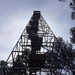
Since we're talking about the wilderness. A couple weeks ago I climbed up a fire tower. It's about 2 miles from my house! I see it every time I drive to Rolla on I-44. Finally went over there due to a geocache being buried on the Fort Wood Tower Site. Cool view! It kept moving with the wind. Scary..lol.
 

Attachments

  • tower2.jpg
    tower2.jpg
    99.7 KB · Views: 815
  • tower.jpg
    tower.jpg
    69.4 KB · Views: 815
Last edited:
Status
Not open for further replies.
Top