
Perhaps minorly OT...
I've had a weather station on-line since 98, and a Boltek lightning tracker on line for almost as many years. By itself, the Boltek is of little utility. It's pretty good at strike azimuth (depending on the accuracy of the antenna orientation) but not that great at range, due to the varying strength of strikes. Here's my current Boltek/Nexstorm page: San Luis Obispo, California Lightning Tracker
To that end, the Nexstorm software added GPS functionality for time stamping, to triangulate strikes. See StrikeStarUS
OK, but still not great. Not enough sensitivity, or enough station density to be effective, especially out here.
Enter Blitzortung. This is a hobbyist supported site that uses custom Internet enabled detectors and a GPS to fairly accurately range strikes using Time Delay of Arrival, or Group Time Delay of Arrival to locate strikes. I built and installed a Blitzortung Red system here in SLO.
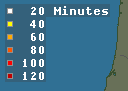
See the California map at Blitzortung.org – lightning map Europe – thunderstorms and lightning strikes. Make sure that the
Strikes
Detectors used
Detectors assigned are selected in the left column, and watch the show.
The US page is at Blitzortung.org – lightning map USA, Canada – thunderstorms and lightning strikes
Click Sound to hear a click every time there is a detected strike.
It's been interesting today to watch the lighting over the Sierra. As I write this, there are still strikes being detected. I suppose there are some fires up there to be dealt with. Also, there were a few strikes local to SLO today.
I've had a weather station on-line since 98, and a Boltek lightning tracker on line for almost as many years. By itself, the Boltek is of little utility. It's pretty good at strike azimuth (depending on the accuracy of the antenna orientation) but not that great at range, due to the varying strength of strikes. Here's my current Boltek/Nexstorm page: San Luis Obispo, California Lightning Tracker
To that end, the Nexstorm software added GPS functionality for time stamping, to triangulate strikes. See StrikeStarUS
OK, but still not great. Not enough sensitivity, or enough station density to be effective, especially out here.
Enter Blitzortung. This is a hobbyist supported site that uses custom Internet enabled detectors and a GPS to fairly accurately range strikes using Time Delay of Arrival, or Group Time Delay of Arrival to locate strikes. I built and installed a Blitzortung Red system here in SLO.
See the California map at Blitzortung.org – lightning map Europe – thunderstorms and lightning strikes. Make sure that the
Strikes
Detectors used
Detectors assigned are selected in the left column, and watch the show.
The US page is at Blitzortung.org – lightning map USA, Canada – thunderstorms and lightning strikes
Click Sound to hear a click every time there is a detected strike.
It's been interesting today to watch the lighting over the Sierra. As I write this, there are still strikes being detected. I suppose there are some fires up there to be dealt with. Also, there were a few strikes local to SLO today.
")
