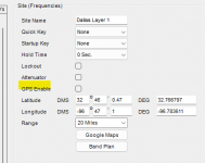
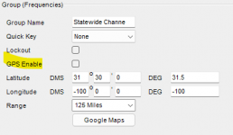
Hi, I just bought a BCD-325p2 and I am trying to see if I can control sites being avoided and unavoided by selecting different latitude and longitude locations in the POI sites I have entered (not using a GPS). Basically I am trying to emulate the zip code function in my BCD-436. I am wanting to enter more sites than are local to me on a statewide system (NCVIPER) and not have to manually avoid multiple sites each time I travel out of my area. Reading the manual it tells how to use a GPS to do this, and it talks about entering POI information but not specifically using them together.
Thanks
Richard
Thanks
Richard


