BCT15X: GPS mobile scanning not switching conventional systems

Status
Not open for further replies.

AronDouglas

Member
Premium Subscriber
Joined
Aug 11, 2013
Messages
366
Location
Southeast Georiga
So I finally went out and got myself a GPS unit for my mobile BCT15X, and so far I'm happy with it. Its accurate when tracking and locks onto my location decently quick. However...after spending about an hour setting up the locations in FreeScan for the location based scanning (the main reason I got the thing), I proudly mounted it in the test truck and sent it to work. I am 99% confident in my programming of the locations and their accuracy. I set each location to the center of each county, then set the range to the average size of the specific county (I scan via county instead of departments like PO or FD). The unit is working flawlessly so far, accurate GPS locating, accurate speed, and good connection, but it wont switch counties.

After reading the manual a few times, I caught this, "...automatically lock and unlock trunked sites and channel groups based on the location information..." Easier to Read Manual. Does this mean it does not switch conventional sites/systems?

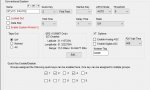
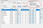
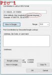
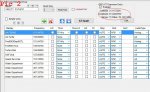
Each conventional system is GPS enabled and the lat/long, and a range is set. The individual groups arent set however, nor is GPS enabled for them (mainly because FreeScan says thats only applicable for XT scanners, and I dont need specific groups enabled, I want them all on with the system).
 

Attachments

  • Clipboard02.jpg
    Clipboard02.jpg
    35.2 KB · Views: 519
  • Clipboard03.jpg
    Clipboard03.jpg
    75.8 KB · Views: 511

ofd8001

Member
Premium Subscriber
Joined
Feb 6, 2004
Messages
7,915
Location
Louisville, KY
I believe the 15X is the non-digital sibling of the 996XT which I've used with GPS for a long while.

Based on my experience, from a GPS standpoint, conventional systems are just like trunked systems. So if you have correctly set your lat/long/range data correctly, they will come on as desired.

You can, but do not have to with this model scanner, set location information for channel groups. That will cause specific groups to turn on/off based on location. (That's helpful for a statewide law enforcement agency still using conventional frequencies. You can have the ABC Post group turn on when in that area, and turn off when you leave that area. Same for Posts DEF, GHI, etc.)
 

marksmith

Member
Joined
Jun 20, 2007
Messages
4,331
Location
Anne Arundel County, MD
To my knowledge the 15x operates the same as the 996xt with regard to GPS and location control, which includes both trunked and conventional scanning.

I have both radios, but generally use other radios when using GPS. Though I have operated both with GPS, programming with Freescan entered locations using the Google lookup tool.

The only real difference between the radios is digital reception.

Mark
536/436/HP1/HP2/996XT/996P2/396XT/325P2/PSR800
 

AronDouglas

Member
Premium Subscriber
Joined
Aug 11, 2013
Messages
366
Location
Southeast Georiga
Yes, the 15 is basically the analog version of the 996.

I managed to tag along with the work truck today that its installed in, and we are well outside of the previous county and into the next...and it didn't switch. I think I'm missing something here.

Is there a range I need to set for the scanner itself? I'm confident in the programming of the counties lat/long and distances, but does the scanner itself have a range to?
 

jonwienke

More Info Coming Soon!
Joined
Jul 18, 2014
Messages
13,416
Location
VA
You need to enable the GPS (check the checkbox) and fill in the GPS coordinates. Then you need to connect the GPS to the scanner while traveling and ensure it is feeding position data to the scanner (there should be an on-screen indication the scanner has a data connection to the GPS).
 

marksmith

Member
Joined
Jun 20, 2007
Messages
4,331
Location
Anne Arundel County, MD
Agree. Sounds like the scanner and GPS are not communicating.

Either the scanner is not seeing the GPS or you don't have GPS enabled on the radio.

Are you getting a GPS indication on the screen?

Mark
536/436/HP1/HP2/996XT/996P2/396XT/325P2/PSR800
 

ofd8001

Member
Premium Subscriber
Joined
Feb 6, 2004
Messages
7,915
Location
Louisville, KY
I remember a couple of frustrating situations where I used a higher baud rate for quick programming, but forgot to turn it back to 4800 for GPS use.
 

UPMan

In Memoriam
Premium Subscriber
Joined
Apr 19, 2004
Messages
13,296
Location
Arlington, TX
For the purposes of that software, the BCT15X is an "XT" model. Click the box and enter lat/lon/range.
 

AronDouglas

Member
Premium Subscriber
Joined
Aug 11, 2013
Messages
366
Location
Southeast Georiga
Could someone link me to a 'How-To' of some sort to program this GPS with FreeScan please, or any other software based programming that works well with the BTC15X and the GPS. I am really lost here, and its only getting worse the more research I do lol. I think I've found a FreeScan bug, but I'm not sure at the moment. The one for sure thing however is that I don't have any GPS system based scanning still.
 

jonwienke

More Info Coming Soon!
Joined
Jul 18, 2014
Messages
13,416
Location
VA
You can't use GPS scanning if your scan data has 0/0 for lat/lon coordinates. That tells the scanner the channel is located in the middle of the Atlantic Ocean, and the channel will NEVER be scanned. You MUST correctly tag each scan item with the correct GPS coordinates.
 

marksmith

Member
Joined
Jun 20, 2007
Messages
4,331
Location
Anne Arundel County, MD
I don't know that there is such a thing. Mainly you just want to follow the scanner manual for location control.

In Freescan, the gps setup is under the site setup for a trunked system, where you check "Use GPS with this site" and edit the location and range of the site.

It will use Google as to assist you in setting this up.

In conventional frequencies, the GPS setup is in the conventional system setup, where you set the same criteria that will be applied to the frequencies you place under that "system".


Mark
536/436/HP1/HP2/996XT/996P2/396XT/325P2/PSR800
 

AronDouglas

Member
Premium Subscriber
Joined
Aug 11, 2013
Messages
366
Location
Southeast Georiga
You can't use GPS scanning if your scan data has 0/0 for lat/lon coordinates. That tells the scanner the channel is located in the middle of the Atlantic Ocean, and the channel will NEVER be scanned. You MUST correctly tag each scan item with the correct GPS coordinates.

I programmed every System and Group with GPS coordinates, still nothing. The unit works, it reads Lat and Long while moving, it just wont switch.


marksmith said:
I don't know that there is such a thing. Mainly you just want to follow the scanner manual for location control.

In Freescan, the gps setup is under the site setup for a trunked system, where you check "Use GPS with this site" and edit the location and range of the site.

It will use Google as to assist you in setting this up.

In conventional frequencies, the GPS setup is in the conventional system setup, where you set the same criteria that will be applied to the frequencies you place under that "system".

I thought it was that easy, I dont know why its not taking it.
 

AronDouglas

Member
Premium Subscriber
Joined
Aug 11, 2013
Messages
366
Location
Southeast Georiga
I just pulled the scanner from the truck and downloaded the entire database from ti to see what was going on. Previously, I had spent about 2 hours putting in and uploading a GPS coordinance to every System and group. When I downloaded the scanners database to FreeScan, it didn't show any Lat/Long information for any of the Systems and the GPS function was unchecked. However, all the Group Lat/Long information was still there and the GPS was still checked 'enabled'.

I am at a confused loss now. This shouldn't be that complicated.
 

AronDouglas

Member
Premium Subscriber
Joined
Aug 11, 2013
Messages
366
Location
Southeast Georiga
I did check the scanner itself (not through FreeScan, but manually at the scanner) and each group has its Lat/Long and GPS enabled for it. I cant find an option under System to set GPS manually.
 
Last edited:

AronDouglas

Member
Premium Subscriber
Joined
Aug 11, 2013
Messages
366
Location
Southeast Georiga
Manually, in the scanner, there is no way to enable GPS for a system, only Groups (that I've seen, in the BCT15X). Everything is enabled and appropriate ranges are set, GPS locates satellites and locks location and tracks....I'll take this out for another test-run later next week and see what's happen. This isn't suppose to be this hard -_-
 

UPMan

In Memoriam
Premium Subscriber
Joined
Apr 19, 2004
Messages
13,296
Location
Arlington, TX
Are these trunked systems? If so, then the location data is at the site and channel group levels, not the system level.

For conventional systems, location is set only at the channel groups level.

Back to your first post, that screen shot shows that you've not set the location for that system. The system-level location for conventional systems only applies to the BCT15 and BCD996T. The method was slightly changed for later models (like the BCT15X which you are asking about). You must use channel group-level location with your model (the system-level setting will not be sent to the scanner, as the scanner has no such setting).

Also, in that first example, the location you've entered corresponds to a point in the Atlantic Ocean about 5 miles off the coast of Jekyll Island, Georgia. I find that location to be rather suspect. RadioReference has 31.2335619N, 81.5331587W as the center point of Glynn county.
 
Last edited:

AronDouglas

Member
Premium Subscriber
Joined
Aug 11, 2013
Messages
366
Location
Southeast Georiga
These are all conventional systems, and this is for the BCT15X.

I've gone back and made sure everything was set at the group level (which is still was), and among my research I found something very interesting.When programing the Lat/Long in the 'Location Settings', the software likes to see the distances written out in Decimal Degrees. After inputting the information and applying it, the software (and scanner) convert the measurements to degrees, minutes, and seconds.

(Pic 1) If you take the distance 31.199228, -81.539664 and search it, you get the roughly central located destination I picked for the Glynn County and its cities.

(Pic 2) If you take the scanners converted measurement and search it in degrees, minute and seconds, (DDD° MM' SS.S) 31°11'57.22 -81°32'22.79 , you get the exact same location. You CANNOT search degrees, minute and seconds in a decimal degrees format. This confused me for the longest time and I thought I found a bug in the software.

The two displayed Lat/Long coordinance are not the same digit for digit, but they are the same if written in the correct format. I have my scanner set to display DDD° MM' SS.S, but I don't see an option in FreeScan to set that as a display, so I don't know why its reading like that.

This is turning into fun research rather than solving a little issue lol
 

Attachments

  • Clipboard01.jpg
    Clipboard01.jpg
    25.9 KB · Views: 284
  • Clipboard02.jpg
    Clipboard02.jpg
    75.3 KB · Views: 232
Last edited:

AronDouglas

Member
Premium Subscriber
Joined
Aug 11, 2013
Messages
366
Location
Southeast Georiga
I guess I should explain a little how I set up the System/Groups. Each System is an entire county (roughly 20 counties in my work area). Under each County/System, there are Groups set for each city. When I enter a county, I want each City/Group to come on. So the GPS Lat/Long may not make sense if you just look them up by coordinance alone, but I do have it all worked out so that it makes sense...to me anyways lol.

Each GPS location is set at the Group level, as that is the only way the BCT15X searches GPS information. And it was double checked manually in the scanner itself. The detection range is set in relation to the radius of the affected area, as per the Easier to Read Manual.
 
Status
Not open for further replies.
Top