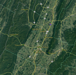
I have never seen any official documentation, but wanted to add a little more explanation. I view (maybe not 100% correct) the H/R system as being a total of three systems that are linked together. They are Valley, Mountain and Feedstone.
Feedstone appears to be a stand alone, single site system. Very little activity here, but it provides coverage out the Rt. 33 West area beyond Rawley Springs. There are also some dead spots going up the mountain to WVa.
Mountain & Valley both have more than one site associated with them. On maus92's map above, I would say that Kaylor Hill, Stone Spring, Tower Street, Lacey Springs, Massanutten Peak, Elkton (I believe on Sapling Ridge Rd) and MAYBE Shank Hill are all part of the Valley Site. And I would call Cooper's Mountain, Little North Mountain and Bergton all part of the Mountain Site system.
The cool thing with the Uniden scanners, is you can make different scanlists for the Valley, Mountain and Feedstone site and toggle them on/off as needed. The cool thing with the Unication pagers is that it will scan for the next control channel if you go out of range of the current control channel.


