VDL2 Ground Stations

Status
Not open for further replies.
D

DaveNF2G

Guest
Dave,


Thanks for that report but are you sure those flights are on 136.650 ? I looked over my logs from this weekend too and and did not catch any flights on 136.650. ALB is 174nm from YOW so our coverage areas overlap quite a bit.

MultiPSK logged them on 136.650 (the frequency at the end of the <RX> line in the QSO file).
 

AirScan

Member
Joined
Feb 13, 2007
Messages
2,859
Dave,

MultiPSK logged them on 136.650 (the frequency at the end of the <RX> line in the QSO file).

From your notes - 2A1457 CAL11 KJFK-RCTP

This is the first message I got from CAL011 to 2A1457

[2018-10-21 07:13:05 GMT] [136.975] [-41.2/-51.0 dBFS] [9.8 dB] [-1.9 ppm]
899018 (Aircraft, Airborne) -> 2A1457 (Ground station): Command
AVLC: type: S (Receive Ready) P/F: 1 rseq: 2

Can you find the same message (time stamp 07:13:05 GMT) in your logs to compare ?

Were all your messages to this flight showing on 136.650 ? Using the New York logs I tracked it from takeoff at JFK until I lost it north of Montreal, and it was always on 136.975 (according to dumpvdl2).

Seems like some sort of MuliPSK glitch ?

AS
 

morfis

Member
Joined
Jan 24, 2004
Messages
1,643
Seems like some sort of MuliPSK glitch ?

Seems unlikely...feed using a receiver it's controlling and it will show the tuned frequency (you can confuse matters using offsets...I did that once - 'operator error')
...feed using vac from another source and the software doing the control will show the frequency (I use SDRsharp with three VFOs but that was really to compare the decodes between Multipsk and dumpvdl2 (which I have set to monitor all four European freqs....I only get traffic on three of them)
 

EricCottrell

Member
Premium Subscriber
Joined
Nov 8, 2002
Messages
2,413
Location
Boston, Ma
Hello,

All the licenses I previously listed use 136.975. There is a pending application to add 136.800 at Logan. Yes, it does add 136.800 and it is not a name change.
ULS Application - Aeronautical and Fixed - 0008378828 - Aviation Spectrum Resources Inc

The VDL2 receiver in the aircraft must be comparing the signal quality of the ground station it is using and other ground stations. The ground station will send out XIDs occasionally if there is no other activity. I suspect that it is so aircraft can measure signal quality when there is no traffic for the ground station.

I also noticed that departing flights will stay with the departure airport while there is good signal quality. This makes it interesting as I see flights from Manchester, NH stay with the same ground station into NE CT, even though other stations are closer.

I suspect there is a reason why aircraft advertise the destination, and ground stations advertise the airport coverage. The aircraft will at some point handoff or connect to the ground station that has coverage at the destination. This seems to be the case from looking at my dumpvl2 logs.

[2018-10-21 14:27:53 EDT] [136.975] [-39.2/-51.3 dBFS] [12.1 dB] [1.5 ppm]
1034DA (Ground station, On ground) -> FFFFFF (Aircraft): Command
AVLC: type: U (XID) P/F: 0
XID: Ground Station Information Frame
Public params:
Parameter set ID: 8885:1993
Procedure classes: 00 01
HDLC options: 20 84 80
N1-downlink: 07 d8
N1-uplink: 07 d8
VDL params:
Parameter set ID: V
AVLC specific options: 20
Airport coverage: KBOS
ATN router NETs: 00 00 00 00 00 00 "......"
System mask: fc 02 00 00
Ground station location: 42.4N 71.0W

[2018-10-21 14:28:59 EDT] [136.975] [-35.3/-50.3 dBFS] [15.0 dB] [2.7 ppm]
7380C5 (Aircraft, Airborne) -> 213E77 (Ground station): Command
AVLC: type: U (XID) P/F: 1
XID: Handoff Initiation
Public params:
Parameter set ID: 8885:1993
Procedure classes: 00 01
HDLC options: 20 a4 88
VDL params:
Parameter set ID: V
XID sequencing: 14
Destination airport: KJFK
Aircraft location: 42.1N 69.6W 32000 ft
Alternate ground stations: 285897 211197
AVLC specific options: 24
Connection management: 01

I experimented with my dumpvl2 log files to see if I can figure out some of the other airports in my receive range. I searched on the four-letter airport code of interest in the ACARS messages and noted the hex codes of the aircraft listing the registration and departure/destination airports. I then search on each hex code and noted the time periods the aircraft communicated with each ground station. Right off one ground station handled all the flights. I then used flightaware to figure out where the flight was at the various times. I found flights were near the airport when using the ground station that handled all the flights.

Albany is at the edge of my receive range, so I can only see aircraft over about 20,000 flying down the Hudson river. I still got one ground station handling all the Albany flights. Most of the flights were to KBWI, so they did not go too high and I started to receive them between Albany and Newburgh. However, there was a flight to Orlando that did a quick climb out so I first saw it near Altamont, west of Albany, and heard it until LOS at the south tip of Staten Island at 38000.

So I can say with some certainty that the following address are at these locations.
10309A KBDL
10349A KALB
10412A KPVD
104CBA KBED
285897 KPVD SITA

So I am going to log and experiment some more.

73 Eric
 

kma371

QRT
Joined
Feb 20, 2001
Messages
6,204
I believe this is Oakland (KOAK), but I cannot copy the ground station from my location. It's the only ground station address showing up on frequency and its the only frequency licensed in my area

1131EA KOAK
coordinates from FCC license, 37 42N, 122 12W

Can someone wiki qualified move all of these over to the wiki??
 
D

DaveNF2G

Guest
Airscan - I will check the log when I get home.

EricC - Thanks for more detailed information. I was running my setup unattended at the time the logs I posted were generated, so I can't say anything about who was talking to whom on other frequencies or in other modes. I will have to do a monitoring session with that purpose some time.

It seems to me that one of the terminals that handles KBDL flights also takes overflow traffic from KJFK flights, which makes identification a little more challenging. Is KJFK getting KBDL messages, or is it the other way around? Maybe it's both. :)
 

AirScan

Member
Joined
Feb 13, 2007
Messages
2,859
Airscan - I will check the log when I get home.

Thanks. I'm curious why there seems to be a difference ?

It seems to me that one of the terminals that handles KBDL flights also takes overflow traffic from KJFK flights, which makes identification a little more challenging. Is KJFK getting KBDL messages, or is it the other way around? Maybe it's both.

I agree it's very hard to confirm GS location based on aircraft position. I've seen switches seconds after takeoff as well as right on touchdown. However I also agree that in most cases aircraft will tend to stay on the local GS after takeoff, not always but usually. With enough data it's probably reasonable to conclude GS location if the aircraft are low enough. Low, like below 2000 feet, being the key.

The radio covering New York is not close enough to get uplinks to confirm GS ID however it is close enough to get the aircraft seconds after takeoff. With lots of traffic and only using data from flights within 1 minute of takeoff I noted the following GS's.

10147A = JFK
10201A = LGA
10405A = EWR
10508A = JFK
10522A = EWR
10547A = LGA
22DE57 = EWR
251977 = JFK
251978 = JFK
251979 = JFK
261C37 = LGA
261C38 = LGA

Also using logs from the YYZ area (thanks Bob).

10145A = BUF (based on aircraft within 1 minute of takeoff and short final)
10190A = ROC (not quite as close, within about 5 minutes of takeoff/landing)

AS
 
Last edited:

AirScan

Member
Joined
Feb 13, 2007
Messages
2,859
kma371,

I believe this is Oakland (KOAK), but I cannot copy the ground station from my location. It's the only ground station address showing up on frequency and its the only frequency licensed in my area

1131EA KOAK coordinates from FCC license, 37 42N, 122 12W

This was posted over on the vdl2 group. Maybe from your own logs ?

https://groups.io/g/acars-vdl2

[2018-10-22 17:21:32 UTC] [136.725] [-42.2/-50.3 dBFS] [8.0 dB]
A5D965 (Aircraft, Airborne) -> 1131EA (Ground station): Command
AVLC: type: U (XID) P/F: 1
XID: Link Establishment
Public params:
Parameter set ID: 8885:1993
Procedure classes: 00 01
HDLC options: 20 84 80
VDL params:
Parameter set ID: V
XID sequencing: 00
Modulation support: VDL-M2, D8PSK, 31500 bps
Destination airport: KBUR
Aircraft location: 37.6N 122.4W 3000 ft
AVLC specific options: 24
Connection management: 00

Can you confirm if 136.725 is actually in use in the San Francisco area ? Or is this a case of incorrect frequency ID ? I don't see 136.725 listed in that area in the FCC database ?

AS
 

EricCottrell

Member
Premium Subscriber
Joined
Nov 8, 2002
Messages
2,413
Location
Boston, Ma
Airscan - I will check the log when I get home.

EricC - Thanks for more detailed information. I was running my setup unattended at the time the logs I posted were generated, so I can't say anything about who was talking to whom on other frequencies or in other modes. I will have to do a monitoring session with that purpose some time.

It seems to me that one of the terminals that handles KBDL flights also takes overflow traffic from KJFK flights, which makes identification a little more challenging. Is KJFK getting KBDL messages, or is it the other way around? Maybe it's both. :)

Hello,

We are just monitoring the wireless part of the data link between the aircraft and the airline/operator/ATC. The ARINC ground stations are networked together and the SITA ground stations are networked together. This slide from a ARINC talk gives an overview of the components.

73 Eric
 

Attachments

  • ARINCNetwork.png
    ARINCNetwork.png
    167 KB · Views: 95

EricCottrell

Member
Premium Subscriber
Joined
Nov 8, 2002
Messages
2,413
Location
Boston, Ma
Thanks. I'm curious why there seems to be a difference ?


I agree it's very hard to confirm GS location based on aircraft position. I've seen switches seconds after takeoff as well as right on touchdown. However I also agree that in most cases aircraft will tend to stay on the local GS after takeoff, not always but usually. With enough data it's probably reasonable to conclude GS location if the aircraft are low enough. Low, like below 2000 feet, being the key.

The radio in New York is not close enough to get uplinks to confirm GS ID however it is close enough to get the aircraft seconds after takeoff. With lots of traffic and only using flights within 1 minute of takeoff I noted the following GS's.

10147A = JFK
10201A = LGA
10405A = EWR
10508A = JFK
10522A = EWR
10547A = LGA
22DE57 = EWR
251977 = JFK
251978 = JFK
251979 = JFK
261C37 = LGA
261C38 = LGA

Also using logs from the YYZ area (thanks Bob).

10145A = BUF (based on aircraft within 1 minute of takeoff and short final)
10190A = ROC (not quite as close, within about 5 minutes of takeoff/landing)

AS
Hello,

I only have high altitude coverage of the New York city area and I tend to get see eastbound flights and lose westbound flights around the eastern tip of Long Island. Last night I looked at JFK flights and came to the same conclusions about JFK.

I am planing on taking trips to Pennsylvania and Quebec over the next year, so I may bring along a mobile station to log any ground stations I come across.

73 Eric
 

AirScan

Member
Joined
Feb 13, 2007
Messages
2,859
Last night I looked at JFK flights and came to the same conclusions about JFK.

I did the same. All JFK departures heading to Europe I saw initially on one of the JFK GS's as listed above. On average they were switching to another GS around 12-15 minutes after takeoff.

AS
 

kma371

QRT
Joined
Feb 20, 2001
Messages
6,204
I do not belong to that group (but maybe I should be) so not my logs. My log of 1131EA is from 136.650. I'm not close enough to the ground station but it's definatly active. I'll monitor 136.725 for activity and get back to you.

kma371,


This was posted over on the vdl2 group. Maybe from your own logs ?

https://groups.io/g/acars-vdl2

[2018-10-22 17:21:32 UTC] [136.725] [-42.2/-50.3 dBFS] [8.0 dB]
A5D965 (Aircraft, Airborne) -> 1131EA (Ground station): Command
AVLC: type: U (XID) P/F: 1
XID: Link Establishment
Public params:
Parameter set ID: 8885:1993
Procedure classes: 00 01
HDLC options: 20 84 80
VDL params:
Parameter set ID: V
XID sequencing: 00
Modulation support: VDL-M2, D8PSK, 31500 bps
Destination airport: KBUR
Aircraft location: 37.6N 122.4W 3000 ft
AVLC specific options: 24
Connection management: 00

Can you confirm if 136.725 is actually in use in the San Francisco area ? Or is this a case of incorrect frequency ID ? I don't see 136.725 listed in that area in the FCC database ?

AS
 

morfis

Member
Joined
Jan 24, 2004
Messages
1,643
Added known ground stations to our wiki
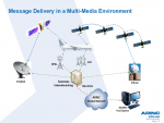
ACARS - The RadioReference Wiki

You have the list breaking up a section on software

Europe:
ACARS 131.525, 131.725 (primary in GB), 131.825
VDL2 136.725, 136.775,136.975 (primary in GB) and 136.875 (nothing noted on it to date here in GB but it's allocated for ground use)
Primary freqs in each case vary through the region

GB ground stations in Multipsk format, (others have been identified but I've not confirmed them)
10912A [EGPD Aberdeen/Dyce 57°12'N 002°12'W] [Aberdeen Dyce]
208B57 [EGPD Aberdeen/Dyce 57°12'N 002°12'W] [Aberdeen Dyce]
214A57 [EGPR Barra 57°00'N 007°30'W] [Barra]
212317 [EGBB Birmingham 52°30'N 001°48'W] [Birmingham]
216B45 [EGVN RAF Brize Norton 51°30'N 001°18'W] [Brize Norton]
229137 [EGPH Edinburgh 55°54'N 003°24'W] [Edinburgh]
230457 [EGLF Farnborough 51°18'N 000°48'W] [Farnborough]
23B025 [EGPF Glasgow 55°54'N 004°24'W] [Glasgow]
260825 [EGNM Leeds Bradford 53°54'N 001°42'W] [Leeds Bradford]
260F37 [EGLC London City 51°30'N 000°00'E] [London]
10919A [EGGW London Luton 51°54'N 000°24'W] [Luton]
11919A [EGGW London Luton 51°54'N 000°24'W] [Luton]
2651C5 [EGGW London Luton 51°54'N 000°24'W] [Luton]
2651D7 [EGGW London Luton 51°54'N 000°24'W] [Luton]
1091EA [EGKK London Gatwick 51°12'N 000°12'W] [Gatwick]
10988A [EGKK London Gatwick 51°00'N 000°12'W] [Gatwick]
11988A [EGKK London Gatwick 51°00'N 000°12'W] [Gatwick]
1191EA [EGKK London Gatwick 51°12'N 000°12'W] [Gatwick]
261EE1 [EGKK London Gatwick 51°12'N 000°12'E] [Gatwick]
261EF7 [EGKK London Gatwick 51°12'N 000°12'E] [Gatwick]
10983A [EGLL London Heathrow 51°30'N 000°30'W] [Heathrow]
11983A [EGLL London Heathrow 51°30'N 000°30'W] [Heathrow]
262242 [EGLL London Heathrow 51°30'N 000°24'W] [Heathrow]
262243 [EGLL London Heathrow 51°30'N 000°24'W] [Heathrow]
262257 [EGLL London Heathrow 51°30'N 000°24'W] [Heathrow]
262258 [EGLL London Heathrow 51°30'N 000°24'W] [Heathrow]
262259 [EGLL London Heathrow 51°30'N 000°30'W] [Heathrow]
10987A [EGSS London Stansted 51°54'N 000°12'E] [Stansted]
29D1D7 [EGSS London Stansted 51°54'N 000°18'E] [Stansted]
29D1D8 [EGSS London Stansted 51°54'N 000°18'E] [Stansted]
1099CA [EGCC Manchester 53°24'N 002°18'W] [Manchester]
2685D7 [EGCC Manchester 53°18'N 002°18'W] [Manchester]
29E737 [EGPO Stornoway 58°12'N 006°18'W] [Stornoway]
10993A [EGPU Tiree 56°30'N 006°54'W] [Tiree]
 
D

DaveNF2G

Guest
I rechecked my MultiPSK QSO file and the frequency logged was 136.650 MHz during the entire session. Whenever the frequency is changed, MultiPSK writes a new <RX> line to the log.

I am not trying to assess the terminal IDs based on aircraft location. I am relying on the route, because any communications from a given flight would only be relevant to people at the origin and destination airports. There is no reason, for example, to address a VDL2 message to Albany if the airline does not serve Albany. It also seems unreasonable to address a message to Albany if the flight is not going there.
 

morfis

Member
Joined
Jan 24, 2004
Messages
1,643
Does it make any difference if an aircraft/airline serves a particular airfield? I see messages addressed to Manchester from flights that aren't going to or coming from there...in all likleyhood they could sucessfully communicate with London or Newcastle (which were the first two sites with ARINC VDL2 terminals here judging by the ancient presentation Eric linked).
Do they use the Manchester address because the sub-system there is not as busy at that time? Does the system actually instruct aircraft which ground terminal to use (as ACARS can)?
Once in the ground system the messages are accessible everywhere so for normal messages it's not important where it entered?
 

ATCTech

Active Member
Joined
Aug 13, 2002
Messages
1,857
You guys are WAY overthinking ground station locations. VDL is a global network, as is HFDL and legacy ACARS. The ground stations to the aircraft or on-ground ATC or AOC facility in effect are similar to you or me not caring what cell tower is handling your phone call or text message at any given moment. Ground stations are located for RF coverage, be that at major airports, at secondary airports or co-located with ATC remote facilities, but not specifically with regard to the ground-based facility message destination. They are really nothing more than a remotely-controlled radio transceiver with a modem and an IP address or two, in an equipment rack of an unmanned location. I know this. I've seen them, touched them, and serviced them. What G/S is used at any particular portion of a data exchange between air and ground is invisible to the origin and destination of the message. The message is not addressed to a ground station, it is addressed to a destination on the network, be that an AOC location or ATC facility.

Bottom line as a casual "viewer" of VDL, if you're not receiving the uplink side of the message exchange then it's pointless to be concerned with where the G/S is located.
 

EricCottrell

Member
Premium Subscriber
Joined
Nov 8, 2002
Messages
2,413
Location
Boston, Ma
Hello,

I have an interest in what ground station an aircraft is using much like when I use an utility on my phone to see where the cellular tower is. Unfortunately the dumpvdl2 program I use does not decode the ISO networking fully, like CLNP. Then it would be more obvious that vdl2 is a big wireless network.

I was trying to figure out KMHT (Manchester, NH) from my logs, but it was difficult. The flights seemed to switch to KBED (Hanscom) by the time I receive the aircraft. I think there are some hills in the way.

I hooked up my RSP2 to my dual band ham antenna in the car and ran dumpvdl2 on the way home from work via Bedford. I was able to get ground stationt info for KBED. I plan on going up to southern NH soon, so maybe I can get KMHT.

Code:
104CBA (Ground station, On ground) -> FFFFFF (Aircraft): Command
AVLC: type: U (XID) P/F: 0
XID: Ground Station Information Frame
Public params:
 Parameter set ID: 8885:1993
 Procedure classes: 00 01
 HDLC options: 20 84 80
 N1-downlink: 07 d8
 N1-uplink: 07 d8
VDL params:
 Parameter set ID: V
 AVLC specific options: 20
 Airport coverage: KBED
 ATN router NETs: 00 00 00 00 00 00	"......"
 System mask: fc 02 00 00
 Ground station location: 42.5N 71.3W

73 Eric
 
Status
Not open for further replies.
Top