
You are using an out of date browser. It may not display this or other websites correctly.
You should upgrade or use an alternative browser.
You should upgrade or use an alternative browser.
Franklin county reception
- Thread starter Ryanwr944
- Start date
- Status
- Not open for further replies.
Scanner you are using is...? Also you didn't specify what system so I'll assume this one?
Law enforcement is entirely encrypted in Franklin County (as denoted by mode "DE" in each LE talkgroup's mode column). Fire & EMS are reportedly in the clear. Lastly Franklin County contains simulcast cells. So unless you're using Uniden's SDS100 or 200 or a Unication G2, G3 or G5 D Band model, I'd anticipate simulcast distortion issues
Law enforcement is entirely encrypted in Franklin County (as denoted by mode "DE" in each LE talkgroup's mode column). Fire & EMS are reportedly in the clear. Lastly Franklin County contains simulcast cells. So unless you're using Uniden's SDS100 or 200 or a Unication G2, G3 or G5 D Band model, I'd anticipate simulcast distortion issues
Last edited:
W3DMV
Member
Need a few more details. Michaux covers Franklin and Adams Counties. Will you be camping and if
so, Caledonia or other? What type of scanner do you have? Both counties are simulcast and The LE
In both counties is encrypted but fire & EMS is in the clear.
Are you interested in forestry and park operations? They were in the
process of moving to the new state P25 system. Will check and see if
they transitioned yet or are still using their old system.
Both areas are heavy simulcast problems so head the advice from Whisky3JMC above regarding receivers
that work with this area.
Very good. So yeah you'll pretty much be limited to Fire & EMS and anything else denoted as mode "D" or "T" on the system. All "DE" and "TE" are fully encrypted
Onelick
Member
Forest District 1 transitioned to the new system last July. We have some dead spots on the forest with the new system, but most of those are in the southern end of the forest near Waynesboro. You should be able to pick up both Franklin and Adams pretty well. Clark's Knob is a straight shot across the valley from Birch Run Road. Quirock signal should be blocked by South Mountain and Peg's ridge. I only have a psr-500 near Waynesboro and don't have any issues with the simulcast.
Onelick
Onelick
dlnorth
Member
- Joined
- Apr 24, 2004
- Messages
- 96
thank you I will let you all know my findings when I get back from the retreat
Michaux State Forest covers Adams, Franklin, and Cumberland Counties. Public safety radio coverage is much better than cellphone coverage throughout most of the forest, including Birch Run Road. I only know of one cabin on Birch Run Road and it's on the northern end of the road, but as a general rule, the closer to Big Flat you go, the higher the elevation, and the better the coverage. I have used a G5 in that area for several years and have had no issues with reception, monitoring mostly Adams County, but also some Cumberland and Franklin. There is an Adams County tower on Big Flat and, as someone else mentioned, you can look across the valley and see the Franklin County Clark's knob site. Franklin County can be received without issue that high on the mountain well past Pine Grove Furnace State Park. Once you get down off of the east side of the mountain, towards SR 233, you'll lose coverage, especially north of Shippensburg Road.
The Cumberland County line is only about 2,000 feet west of Birch Run Road, on Shippensburg Road, and there are UHF simulcasts available of their fire/EMS OpenSky talkgroups in the Shippensburg area that you can easily receive from the Big Flat area. Frequency information is available in the RR database.
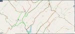
Also, just so you are aware, Birch Run Road is completely located within Adams County and the only place that it gets anywhere close to Franklin County is down near the reservoir on the south end of Birch Run Road, near Milesburn Road. You can easily monitor the Franklin system anywhere along Birch Run Road, but you won't hear much activity related to the area you're staying if you are on the northern section of the road. You'll hear a lot more local activity, to the extent there is any in that area, from Adams and Cumberland.
Lastly, with regard to cellphone coverage, most of that area does have very poor cellphone coverage. I have mapped coverage of all four major carriers throughout most of Michaux State Forest using mostly Cellmapper, but also a few other cell coverage mapping apps, and in that area, AT&T, seems to have the best coverage. They have a tower located at 1700 Ridge Road, which is the only cell tower located anywhere near where you'll be staying, although in spite of that, there are still plenty of places along Birch Run Road where even AT&T drops coverage. If you decide to go to the reservoir, look west from the boat launch and you'll see the AT&T cell site. There is a Franklin County repeater co-located on that tower as well, which is why the coverage of that system is so good in that area.
Attachments
Doh! Hate it when that happens! But I would venture to say reception would have been quite good within 15 miles of the county line even in thick terrain. I had copied a control channel on an SDS100 scanner(not quite as good range) from near the top of Ephrata Mountain in Lancaster County some nearly 60 miles away.
I basically had everything almost correct but forgot to put the site information. At one point before getting to Birch Run Rd I was able to get carol county Maryland believe I was getting it on Milesburn rdDoh! Hate it when that happens! But I would venture to say reception would have been quite good within 15 miles of the county line even in thick terrain. I had copied a control channel on an SDS100 scanner(not quite as good range) from near the top of Ephrata Mountain in Lancaster County some nearly 60 miles away.
- Status
- Not open for further replies.
Similar threads
- Replies
- 1
- Views
- 433
- Replies
- 11
- Views
- 742