I clicked on the link above for the Missouri railroad frequencies and saw terms like this used:
UPRR River Sub - Eton Jct to River Jct
This is just for an example.
How would I, a brand new railfan scanner, figure out where in the heck this is located? Are there railroad maps somewhere that show the different junctions?
My question relates to this section of track:
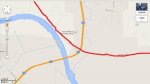
http://goo.gl/maps/mY7os It is a section of railroad track that runs along the Missouri river right at the Ks/Mo border along Interstate 435. See the map above and the picture I've attached. Many times I see trains rolling thru there or stopped waiting for others to pass, and I would like to know how to listen to these trains?
Thank you! Matt in Kansas City