Hello all,
In July, California State Parks issued its 2019 map which had some district/park unit reorganization when compared to the 2018 map. I've attached a text file with the park units and the districts they fall under, and a 2018 map (.jpg) and a 2019 map (.pdf).
There's a lot of smaller to moderate changes, including different park units now under falling under different districts due to boundary line adjustments, district disbanding, district merging, etc.
Some larger changes of note:
As far as database radio changes, there's some work that needs to be done, nothing too major. Most if not all of the mountain top repeaters likely have the same park unit assignments, just the district organization within the database needs some work. I can try to get this submitted.
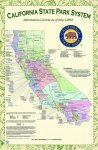
In July, California State Parks issued its 2019 map which had some district/park unit reorganization when compared to the 2018 map. I've attached a text file with the park units and the districts they fall under, and a 2018 map (.jpg) and a 2019 map (.pdf).
There's a lot of smaller to moderate changes, including different park units now under falling under different districts due to boundary line adjustments, district disbanding, district merging, etc.
Some larger changes of note:
- Two of the OHV districts (San Andreas, Twin Cities) have been disbanded, and the OHV units they managed now fall under the wide-area DPR district they are physically located in.
- The other two OHV districts (Oceano Dunes, Ocotillo Wells) are now (more-or-less) regular wide-area DPR districts. With this, they have expanded their boundaries and taken some park units from the adjoining districts they squeezed.
- The Colorado Desert District is now considerably smaller due to Ocotillo Wells District boundary expansion.
- The Tehachapi District has been renamed to the Great Basin District and realigned its boundaries. It has lost the Providence Mountains SRA, now part of the Inland Empire District.
- A newly formed Diablo Range District has taken a large part of the eastern portion of the Bay Area District, the northern portion of the Monterey District, and the western portion of the Gold Fields District.
- The Bay Area District is now mainly Marin County and portions of Sonoma and Napa counties.
As far as database radio changes, there's some work that needs to be done, nothing too major. Most if not all of the mountain top repeaters likely have the same park unit assignments, just the district organization within the database needs some work. I can try to get this submitted.