- Joined
- Mar 15, 2004
- Messages
- 389
18 years back I was in a small bus ("Combi" Van) that traversed the route Leimebamba- Celendin in the northern Amazonas region, that crossed the massive Mara~non gorge. At the bottom of the gorge, in Balsas, you cross the river into Cajamarca region.
At the top, on the Amazonas side, is the 3500 Meter-high Calla Calla Pass. This is in itself not remarkably high in Peru, but the view from this spot is extremely dramatic, even by Andean standards. I was riding up front with the driver, and I asked him about radio reception along this high spot. He told me it was amazing, and said you could hear Lima radio stations from there; he turned on the radio, tuned around, and demonstrated a station from Lima on the ordinary dashboard radio.
Google Earth says this is 610 KM to the Morro Solar TX site used by almost all Lima stations.
I would call BS on this assertion on the surface, but Peru is really a land of many mysteries and miracles, as well.
Many major radio outlets, like RPP Noticias, and Radio Nueva Q, do have stations all over the country that carry their programming, but he said you could hear numerous stations from that high point , that actually were in Lima. I got to know the gentleman, and his son-- who also owned the hotel I stayed in during my stay in Celendin-- and they were very honest and trust-worthy folks. The only place that had any radio stations in possible line-of-sight from there were below in Balsas, about 30 KM downhill. Even then, the river bottom at Balsas is not visible from up top.
The stations listed on the Peru Ministerio de Transporte y Communicaciones website in Balsas have 100W, and 50W respectively. I am sure he knew them well, from years on this route.These folks drove this route both ways, once a week, and were familiar with every curve, and knew all the folks we encountered along the route. I feel certain his statement about the Lima stations was true.
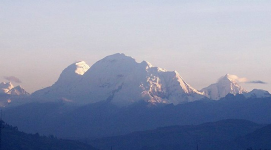
Now, map direct-lines and radiogoniometric plots can differ, depending on the type of map. On the Google Earth map (which I am having difficulty pasting here) shows the path to Lima from Calla Calla passes over the Cordillera Blanca, which has Peru's highest peak-- Huascaran,-- at 6700 Meters high. Huascaran, for example, has a 2000 Meter snow and ice wall on it, and many adjoining peaks have huge snow and ice ramparts.
The distances, and obstacles, sound insurmountable.
I realize this must sound like a radio fairy tale, but I have to seriously wonder if Calla Calla gets some type of signal refraction from the Cordillera Blanca, or has an unusual climatic condition that somehow creates frequent ducting into it. Yes, I fully understand the curvature of the planet over this enormous distance, and the other factors, as well.
Not offended if you don't believe it, just my true experience.
Enough of my wordiness. How could this be?
p1879


