Mapping of some tower sites on Google Earth

Status
Not open for further replies.

Tim-in-TX

Member
Premium Subscriber
Joined
Oct 12, 2004
Messages
288
Location
Pearland TX
Don't know if anyone else would be interested in these, but I was bored during quarantining and created some kml files for the tower sites and coverage ares for several of the systems found in Texas. PLEASE NOTE: I created these for ME, so they may not be useful to anyone else but me, but I thought that I would share them nonetheless...just in case. I am sure some may find errors, or the files are not set up the way THEY would do it, so you can keep your criticisms to yourself.

I know you can view the individual Tower location/coverage info when you click on the tower name for each system, but could not find a map that included all towers at one time, so I created these. Each system is broken down by county, then by tower site and coverage area. Each county and sites can be turned on or off as needed, so you can show as many, or as few sites as desired. Again, I set these up they way I wanted and use them. If you don't like them, then move on.

I created files for TxWARN, GATRRS, LCRA, SAUA, SETRRS & San Antonio/Bexar County. If you download them, you will need to change the extension from .pdf to .kml ( could only attach them as .pdf files) before loading them to Google Earth.

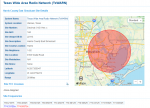
Screen shot examples:
8507685077
 

Attachments

  • GATRRS Towers.pdf
    243.4 KB · Views: 31
  • LCRA.pdf
    110.9 KB · Views: 19
  • San Antonio-Bexar Co.pdf
    30.8 KB · Views: 21
  • SAUA (Bexar Co).pdf
    19.6 KB · Views: 7
  • SETRRS.pdf
    15.8 KB · Views: 9
  • TxWARN Towers.pdf
    290.9 KB · Views: 39

Tim-in-TX

Member
Premium Subscriber
Joined
Oct 12, 2004
Messages
288
Location
Pearland TX
Don't know if anyone else would be interested in these, but I was bored during quarantining and created some kml files for the tower sites and coverage ares for several of the systems found in Texas. PLEASE NOTE: I created these for ME, so they may not be useful to anyone else but me, but I thought that I would share them nonetheless...just in case. I am sure some may find errors, or the files are not set up the way THEY would do it, so you can keep your criticisms to yourself.

I know you can view the individual Tower location/coverage info in the RR Database when you click on the tower name for each system, but could not find a map that included all towers at one time, so I created these. Each system is broken down by county, then by tower site and coverage area. Each county and sites can be turned on or off as needed, so you can show as many, or as few sites as desired. Again, I set these up they way I wanted and use them. If you don't like them, then move on.

I created files for TxWARN, GATRRS, LCRA, SAUA, SETRRS & San Antonio/Bexar County. If you download them, you will need to change the extension from .pdf to .kml ( could only attach them as .pdf files) before loading them to Google Earth.

Screenshot Examples:

8507885079
 

Attachments

  • GATRRS Towers.pdf
    243.4 KB · Views: 16
  • LCRA.pdf
    110.9 KB · Views: 14
  • San Antonio-Bexar Co.pdf
    30.8 KB · Views: 14
  • SAUA (Bexar Co).pdf
    19.6 KB · Views: 3
  • SETRRS.pdf
    15.8 KB · Views: 2
  • TxWARN Towers.pdf
    290.9 KB · Views: 14

TexScan780D

Member
Premium Subscriber
Joined
Feb 20, 2003
Messages
1,162
May I have the point file for GATRRS Towner? I see what to do to get the KML file, thanks. Do you have instructions on how to do this?
 

Tim-in-TX

Member
Premium Subscriber
Joined
Oct 12, 2004
Messages
288
Location
Pearland TX
I found a site that would automatically generate a radius around a point. All you have to do is create a CVS file with the Longitude, Latitude, and radius (in kilometers) and it generates a kml file. It even allows you to generate multiple points at a time.

FreeMapTools.com

Also, I am not sure what you mean by "point file". Would these work better if I saved them as kmz files? I am not 100% sure what the difference between kmz and kml is. I looked it up, but my brain is having issues with understanding the difference.
 

TexScan780D

Member
Premium Subscriber
Joined
Feb 20, 2003
Messages
1,162
May I have the point file for GATRRS Towner?
I found a site that would automatically generate a radius around a point. All you have to do is create a CVS file with the Longitude, Latitude, and radius (in kilometers) and it generates a kml file. It even allows you to generate multiple points at a time.

FreeMapTools.com

Also, I am not sure what you mean by "point file". Would these work better if I saved them as kmz files? I am not 100% sure what the difference between kmz and kml is. I looked it up, but my brain is having issues with understanding the difference.
I have the radius KML file looks good, but can you share the CVS file for GATRRS towers to get the point locations? My ESRI ArcMap will make a center point from the radius's.
 

hiegtx

Mentor
Premium Subscriber
Joined
May 8, 2004
Messages
11,185
Location
Dallas, TX
I found a site that would automatically generate a radius around a point. All you have to do is create a CVS file with the Longitude, Latitude, and radius (in kilometers) and it generates a kml file. It even allows you to generate multiple points at a time.

FreeMapTools.com

Also, I am not sure what you mean by "point file". Would these work better if I saved them as kmz files? I am not 100% sure what the difference between kmz and kml is. I looked it up, but my brain is having issues with understanding the difference.
Very nice job, Tim

I'll have to try this on some of the systems here in the DFW metro area.
 

hiegtx

Mentor
Premium Subscriber
Joined
May 8, 2004
Messages
11,185
Location
Dallas, TX
How did you get a Long and Lat file of the towers?
I'll use one of the TxWARN sites for an example.

Go to the system in the database

Pick a site from the list

85101

That takes you to a page with the site's details:

85103

The latitude, longitude, and range (set in the database) is on the page you get.

The latitude & longitude values are centered on the area covered.

Unless someone has submitted a specific range for a site, the range is set by whoever enters the data. I think they have a set rule for a range to use. For a single site, like for one specific county, the range would be set to cover the jurisdiction for the agency (or multiple agencies) that utilize that site. Maybe one of the DB Admins can shed a little more light on how range is set.

The site I used for an example is a simulcast site. To get the individual towers and their locations, you would have to drill down to the licensing information. Clicking on the small icon near the lower left of the map (I highlighted it) would get you to a page showing the sites.
For this specific site, you won't be able to see that, since the site is using frequencies licensed to the state, and there is not a specific license with location details that you can see.

Look at the map for the Montgomery County Simulcast site:
85104

It does have licenses shown, and you can click on the icon by the map.
85105

This is where you would need to really research if you wanted to specifically include each physical tower for a simulcast site. What you see above are the tower locations for the licenses linked to the site, in this case there are three licenses involved. The site details label the site shown as a "five site simulcast", but obviously, there are more than that on the map. You would have to drill down into the licenses shown, to determine which sites are really part of this simulcast. Licenses often fave frequencies for more than one location, so it's doubtful that every last one of the bullet points shown are exclusively for the Montgomery County Simulcast.
 

Attachments

  • 1589849804198.png
    1589849804198.png
    230.4 KB · Views: 1

rvacs

Member
Premium Subscriber
Joined
Jul 3, 2003
Messages
417
Location
Tulsa, OK
Tim this is very nice...thank you !! For some of these complex layouts of Simulcast - Like GATTRS (Austin area) this is very helpful.

REALLY APPRECIATE YOUR WORK !!!
 

nd5y

Member
Joined
Dec 19, 2002
Messages
11,282
Location
Wichita Falls, TX
I am not 100% sure what the difference between kmz and kml is. I looked it up, but my brain is having issues with understanding the difference.
.kml is "keyhole markup language" which is in plain text. You can view or edit it with a text editor.
.kmz is a compressed .kml file. AFIK you can only open it with Google Earth. I don't remember which compression type it is.
If you open one type with Google Earth you can save the file as the other type if necessary.
 

nd5y

Member
Joined
Dec 19, 2002
Messages
11,282
Location
Wichita Falls, TX
If anybody is interested in Google Earth maps of DPS, TXDOT, TPWD and TFS tower sites you can find them in the wiki articles for each agency.
 

RaleighGuy

Member
Premium Subscriber
Joined
Jul 15, 2014
Messages
13,252
Location
Raleigh, NC
Slightly off topic, but somewhat related, attached are the instructions I got awhile ago on how to create a Google Earth map of radio license near you. Worked really well for me.
 

Attachments

  • Google Earth FCC Data.pdf
    103.5 KB · Views: 42

rvacs

Member
Premium Subscriber
Joined
Jul 3, 2003
Messages
417
Location
Tulsa, OK
If anybody is interested in Google Earth maps of DPS, TXDOT, TPWD and TFS tower sites you can find them in the wiki articles for each agency.


DPS would be very nice... a lot of work but very nice.
 

OhSixTJ

Member
Joined
Feb 9, 2014
Messages
277
looking at the txwarn file I see a pretty big "mobile" site. I haven't searched yet nut what is that and why is the coverage so large?
 

tunnelmot

Member
Premium Subscriber
Joined
May 9, 2007
Messages
427
Location
Conroe, TX
looking at the txwarn file I see a pretty big "mobile" site. I haven't searched yet nut what is that and why is the coverage so large?
I believe it's a site on wheels (SOW) so it may be geotagged as showing coverage anywhere in the footprint of the system. I could be wrong though, I;m always open to correction.
 
Status
Not open for further replies.
Top