Denny (and others):
COMMONWEALTH
BEDF02 WPWS622 39.82994,-78.54350 Chaneysville - OFF TOWER ROAD, WEST OF CHANEYSVILLE
BEDF02 WQWE404 39.82994,-78.54350 Chaneysville - OFF TOWER ROAD, WEST OF CHANEYSVILLE
BEDF03 WPZS824 40.00261,-78.40014 Everett - 1 MILE SW OF BEDFORD
BEDF13 WPWS616 40.29550,-78.57350 Queen - BLUE KNOB, END OF PARK ROAD
BEDF30 WQTQ744 39.85031,-78.73464 Hyndman - 4157 Hyndman Road
BEDF601 WQTF955 40.03075,-78.49814 Bedford - RR5, BOX 310 E
BEDF602 WQTF956 39.80303,-78.67233 Bedford - 3197 BEDFORD VALLEY ROAD
BEDF603 WQTE784 39.88833,-78.66158 Buffalo Mills - OFF MILLIGAN COVE RD
BEDF604 WQTE808 39.85436,-78.63111 Hyndman - 5360 BEDFORD VALLEY ROAD
BEDF605 WQTF958 39.76492,-78.66536 Bedford - 645 EVITTS CREEK ROAD
BEDF630 WQTE856 39.97975,-78.55164 Bedford Springs - 2690 CUNBERLAND ROAD
BEDF641 WQTI214 40.28806,-78.56222 Claysburg - BLUE KNOB SKI AREA
BEDF691 WQTS271 39.78797,-78.40528 Clearville - 2628 CLEAR RIDGE ROAD
BEDF692 WQTF958 40.15806.-78.36889 Hopewell - 1363 WOODBURY PIKE
FULT06 WQBL872 40.12744,-78.17028 Coaldale - OFF SR 1025, 4 MILES SE OF COALDALE
PTC
WRDT289 40.00300,-78.39936 Everett - 1/2 MI SW OF EVERETT
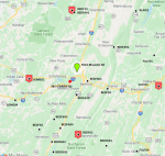
NOTE: I didn't lookup DCNR sites or anything other than Commonwealth and PTC Yx trunked sites.
NOTE: Not on the map is the Kinton Knob Fire Tower (DCNR site) - It is in between Manns Choice and Bedford on the map, right smack dab in the middle of the green area - 40.01369,-78.55558
Mike