Background
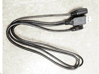
I have the GlobalSat BR-355S4 GPS Receiver (puck) and the Uniden BC-UTGC GPS Adapter Cable for my SDS100. The GPS puck "appears" to be working fine and my SDS100 seems to see it because "GPS" is displayed on the screen. I use a favorite list (FL) for my home county (Oneida) and FLs for each of the surrounding CNYICC counties (Madison, Onondaga, and Oswego). All of the FLs are active and selected. I also have all of the Service Types turned on. I can switch the county FLs on/off as needed. For the problem below, all four of the FLs were on.
Problem
I started my day from Oneida County with the SDS100/GPS combo. When I plugged in the USB connection, the SDS100 immediately saw the GPS and I was scanning the CNYICC Oneida County FL. The problem - the SDS100 didn't switch to the other FLs (counties) as I traveled through them. Example - I left Oneida County and traveled through Madison and then into Onondaga County. When I arrived at my destination in Onondaga County I noticed the SDS100 was still trying to receive Oneida County. I switched off the Oneida County FL and then switched it back on. As soon as I did that, the SDS100 displayed the typical "Scan Mode, Nothing to Scan" message. It seems like my actions triggered the GPS to read again and then the radio determined I was outside the GPS reception circle for Oneida County.
The other issue that you have already guessed - why didn't the SDS100 switch to Madison and eventually to Onondaga County? As stated above, all of the FLs were selected from the start. While sitting in the parking lot at my destination in Onondaga County, I manually deselected the Onondaga FL and then selected it again. You guessed it, the SDS100 started scanning the Onondaga County FL. But why did it take my intervention (FL off/on toggle) to make this happen?
I tried this again on my way home. For this test, I restarted my SDS100 up in Oswego County. I verified that all four county FLs were still selected. As soon as the SDS100 booted, it started to scan the Oswego County FL and ignored the other three FLs. This is obviously correct because I was clearly within Oswego County. As I travelled home, I crossed back into Oneida County and noted the SDS100 kept on scanning the Oswego FL. When I got home (within Oneida County), I checked again and the radio was still scanning the Oswego County FL. I deselected the Oswego County FL and it showed the same "Scan Mode, Nothing to Scan" message. It should have scanned the Oneida County FL with no human actions! When I toggled (deselect/select) the Oneida County FL the SDS100 woke up and started scanning the Oneida County FL. Why?
Is the GPS timing out? The SDS100 display never stopped showing the GPS text. This puck also blinks when plugged in. Is there a way to test the GPS with a PC? What am I missing?
Anyone?