Big Cottonwood Canyon = Scotts Peak
It was also suggested that Site 40 be changed from "Hansel Mtn" to "Snowville" since that's the FCC name. Any thoughts?
-Tim
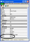
Since the old Site 25 data was poor (1 freq, no license) I went ahead and made 857.9875 the CC and added the license. I also changed the name to from BCC to "Scotts Peak" as suggested by a group member since that's the FCC name. The site is on the boundary between Brighton & Park City.I was up BCC a couple days ago and got no traffic on the 860 Mhz control channel. I did found a CC of 857.9875 that has affiliated with 7202. Does anyone have a file of this CC up there and all the alternate CC or other voice freqs. There was no traffic on the site (weekday afternoon) so i didn't find out more.
It was also suggested that Site 40 be changed from "Hansel Mtn" to "Snowville" since that's the FCC name. Any thoughts?
-Tim