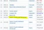
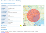
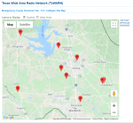
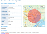
Don't know if anyone else would be interested in these, but I was bored during quarantining and created some kml files for the tower sites and coverage ares for several of the systems found in Texas. PLEASE NOTE: I created these for ME, so they may not be useful to anyone else but me, but I thought that I would share them nonetheless...just in case. I am sure some may find errors, or the files are not set up the way THEY would do it, so you can keep your criticisms to yourself.
I know you can view the individual Tower location/coverage info when you click on the tower name for each system, but could not find a map that included all towers at one time, so I created these. Each system is broken down by county, then by tower site and coverage area. Each county and sites can be turned on or off as needed, so you can show as many, or as few sites as desired. Again, I set these up they way I wanted and use them. If you don't like them, then move on.
I created files for TxWARN, GATRRS, LCRA, SAUA, SETRRS & San Antonio/Bexar County. If you download them, you will need to change the extension from .pdf to .kml ( could only attach them as .pdf files) before loading them to Google Earth.
Screen shot examples:


