Actually ZTL, ZDC, and to a much smaller extent ZJX (Jacksonville) provide air route ATC services in North Carolina Chris. You can examine those frequencies from the listing off the
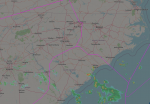
North Carolina Scanner Frequencies and Radio Frequency Reference page. The map below will give you a rough idea of the boundaries for each ARTCC. As I mentioned above ZJX has only a small silver of airspace in NC. Since you are at RDU your airspace will be managed by ZDC. Areas just to the east will be controlled by ZTL. Depending on what you want to hear and how far away from your QTH you want to monitor enroute ATC activity, that will determine what you program into your scanner. As for the airspace directly over RDU, it is controlled by two sectors (low/high) from ZDC and the Johnsonville RCAG (Remote Center Air/Ground) site.
Johnsonville, NC - RCAG
| Frequency | Input

| License | Type | Tone | Alpha Tag | Description | Mode | Tag |
|---|
| 118.92500 | | | | | ZDC36 RAL-H | Sector 36 Raleigh High | AM | Aircraft |
| 135.20000 | | | | | ZDC27 LIB | Sector 27 Liberty Low | AM | Aircraft |
| 322.45000 | | | | | ZDC36 RAL-H | Sector 36 Raleigh High | AM | Aircraft |
| 348.65000 | | | | | ZDC27 LIB | Sector 27 Liberty Low | AM | Aircraft |
That should help get you started. Good hunting de Larry.
View attachment 87719


