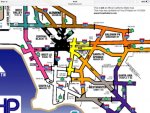
Before anyone says such as this question being asked and answered “six years ago”, yes… I know there is a CHP coverage map, for the greater Los Angles area, which was published on the freqofnature website. However, that map was last updated in 2004, and there have been some changes since then. Someone posted that there was “another map on the CHP Wiki page”, but I haven’t been able to find it. Can anyone help me find that?
I would like to know precisely where each division begins and ends, and not only that, but which “beats” are which, which unit covers which stretch of road. The editor of the “Southern California” section of the old RCMA newsletter would publish these kinds of maps. Unfortunately, I no longer have those issues.
I would like to know precisely where each division begins and ends, and not only that, but which “beats” are which, which unit covers which stretch of road. The editor of the “Southern California” section of the old RCMA newsletter would publish these kinds of maps. Unfortunately, I no longer have those issues.