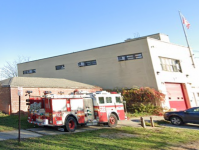
I have been plotting FDNY stations on Google Earth based on the data from NYCOpenData and have found some issues.
Some stations appear (from Street View) to be closed or inaccessible.
Bronx - Engine 82
Brooklyn - Engines 224 and 253
Manhattan - Engines 13, 35, 53 (35 and 53 are addressed around the corner from each other, but the entire area is closed off)
Also in Brooklyn, the city data indicates that Ladder 102 is alone, but the station is marked for an Engine and a Battalion Chief (can't make out the numbers on the picture).
Still working my way through Manhattan.


