Is there a good map of DPS sites?

Status
Not open for further replies.

Gilligan

Member
Database Admin
Joined
Dec 19, 2002
Messages
2,136
Location
Hagerstown, MD
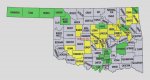
Does anyone have a good map that shows placement of the different DPS towers/sites? I believe there is one available for the OKC EDACS system. A good DPS map would be extremely helpful to people traveling through the area to see what towers they need to program. One that showed present and future towers in different markings/colors would be even better. Anyone know of such a map?
 

ham612

Member
Joined
May 15, 2004
Messages
75
Location
Out in the sticks of N.E. OK.
I have this one with the counties that have, or will have in the near future, a facility in place. I'm afraid it wont be of much help for the specifics you were needing though.

I quickly put it together to get a better idea of how the system as a whole is taking shape. Counties in yellow have at least one facility in place, green indicates future sites. I know it's rather crude but it served it's purpose for what I was doing at the time. This is my first attachment to a post so hopefully I did it right.
MS
 

Attachments

  • counties with state system going in 1-2007a.jpg
    counties with state system going in 1-2007a.jpg
    151.7 KB · Views: 320

plaws

Member
Premium Subscriber
Joined
Jan 3, 2005
Messages
1,717
Location
E Hawkesbury Twp, ON
ham612 said:
Counties in yellow have at least one facility in place, green indicates future sites. I know it's rather crude but it served it's purpose for what I was doing at the time. This is my first attachment to a post so hopefully I did it right.
MS

Looks good - thanks.

Folks need to keep in mind that radio waves refuse to follow political boundaries - i.e., I'm sure the Norman site covers a fair chunk of McClain Co and so on. Good map.
 

xxxsandman

Member
Joined
Aug 1, 2004
Messages
83
Most of Rogers County should have good coverage from the new Pryor site, as the Pryor tower sits only a mile from the Rogers/Mayes County line on a big hill that overlook both counties.
 

freqscout

Member
Joined
Jan 21, 2006
Messages
700
The Baker's Peak site is messed up...it only has the right half of the circle.

Also Vinita (015) is in the wrong place... the Vinita site is north of Pryor.

That map is still pretty good though.

You should plot one with the future expansions too.
 
Last edited:

mam1081

Member
Feed Provider
Joined
Dec 19, 2002
Messages
1,103
Location
Next to a scanner...
freqscout said:
The Baker's Peak site is messed up...it only has the right half of the circle.

Also Vinita (015) is in the wrong place... the Vinita site is north of Pryor.

That map is still pretty good though.

You should plot one with the future expansions too.

I'm not sure about that Baker Peak site - maybe it's on the north side of a mountain or something. I'll double check that propogation survey on that one.

I fixed the Vinita site on the kmz file. I did not fix the Vinita site on the propogation yet - I'll get that tomorrow.
 
Status
Not open for further replies.
Top