If you use ADS-B Exchange or airplanes.live, when you click on the chopper you'll see in your browser's address bar a hex ID that may look like this: ae51ed. Armed with that hex ID you can now bookmark the link to only that aircraft or aircraft's where the link will look like this:
Code:
https://globe.adsbexchange.com/?icao=ae51ed
<--- (Replace hex ID with the chopper/s you're interested in). Now bookmark that link.
The query ?icao= will show the aircraft on the map for 24 hours as well as live if present. If you want to see the aircraft in real time ONLY use the query ?icaoFilter= Which would look like this:
Code:
https://globe.adsbexchange.com/?icaoFilter=ae51ed
<--- (Replace hex ID with the chopper/s you're interested in).
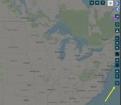
Also note the time machine option (see screenshot). It goes by UTC time. So if a chopper was flying at 2 pm your time, the UTC time from your location (assuming South Carolina) would be 6 pm. Or +4 hours. That is current now in daylight saving time. Once we move ahead an hour in November you'll need to use +5 hours.
I use the time machine all the time when I'm out on the patio having a smoke and I hear a plane in the early morning hours and wonder just who that could be. Once I get back inside I use the time machine option and go back and look. Often it's a med transport plane. Hardly anyone else is flying at that time at night. I know because I have a dedicated small computer monitoring my airspace 24/7. If they are flying at that time I'm tracking them and doing some research. LOL
ADS-B: Automatic Dependent Surveillance Broadcast. Uses mode-s and provides GPS coordinates. Sometimes (or most often) military aircraft only use mode-s. So there is no location transmitted via the transponder. Which means a minimum of 4 ground stations feeding to ADS-B Exchange or airplanes.live are needed to locate and track these aircraft using MLAT, or
multilateration.
Hex: Meaning 6 or six characters.
Now you know, and knowing is half the battle...