Is there a site map out there that shows where the sites are located and their coverage with out clicking on each one individually?
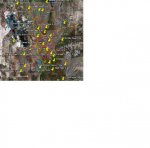
I have entered all the sites and the radii in which I want to listen to them. I used MapSource because it is the map program used with my Garmin GPS's (is plural gpii ?). If you happen to have Mapsource I can send the file, then you could change the radii, show only sites of interest to you, and add new sites. Otherwise I can do a screen print and send the image.
I have one group set up for the actual physical sites, and another group to identify the center of the area where I want to monitor. I call these 'Virtual Sites'. They are useful for my BCT15 because it uses a GPS to lock and unlock sites as I drive. It is sweeet! But to show all the sites at the same time along with all the radii and the towns and roads, it becomes unreadable with too much information.
I tried to figure out how to make an overlay or some other way to do it in GoogleMaps like the RR database, but never figured it out. I would love it if someone could tell me how to do this in GoogleMaps.
B.Christensen
.