SDS200 question

garys

Member
Premium Subscriber
Joined
Jun 13, 2002
Messages
6,092
Absolutely. You can do that under "Location" in Settings. MENU|LOCATION||SET RANGE. Same area where you set find Auto Locate.
That will set the GPS controlled scanner range. I use 0.0 to make it as tight as possible. It's not really zero, but the late Uniden Project Manager "UPMan" recommended it as well some years ago.

If that's not enough, if you program your own systems, you have to put in a Lat/Long and range for each site and department. That's if you want to use GPS based scanning.

As you're probably starting to see, these "computers that think they are scanners" have a lot of options and it can take some time to learn how to use them all to achieve the best results.

Zipcode based scanning will look for systems in the area you enter, plus the database will be checked against the "Service Types" you have enabled. Range also effects that.

Did I mention that these scanners are complicated?

This site Easier to Read SDS100/200 Digital Scanner Manual is an easier to read version of the manual. It's good for looking things up when you hit a road block.


Wait….. range control???? Like setting the radius the scanner will pick up? I’m confused now lol. I know you can set your zip code but will the scanner actually avoid signals that are outside a certain defined range? And is a gps module required for this? Hmm???
 

Randyk4661

Active Member
Premium Subscriber
Joined
Jun 27, 2019
Messages
500
Location
Garden Grove, CA
Wait….. range control???? Like setting the radius the scanner will pick up? I’m confused now lol. I know you can set your zip code but will the scanner actually avoid signals that are outside a certain defined range? And is a gps module required for this? Hmm???
Yes, although the ranges set in the database are generally larger than the actual area the department may cover.
Example, CHP in California, the offices are set to cover the entire county even if they only cover a small portion of said county.

Do a search for GPS range control, lots of posts on range control
 

shansmi

Member
Premium Subscriber
Joined
Aug 20, 2022
Messages
133
Wait….. range control???? Like setting the radius the scanner will pick up? I’m confused now lol. I know you can set your zip code but will the scanner actually avoid signals that are outside a certain defined range? And is a gps module required for this? Hmm???


That does not work that way. "Range Control" is just what gets loaded. If you define a location and range the unit will load from the full database or fav list only those sites that fall into the range from the set location... i.e. a GPS, LAT/LONG or ZIP (zip goes to the lat/long of city hall usually) and a range of 10 miles (default)... she will load up only those sites that fall in that 10 mile range. remember there could be sites in the list from many miles away. This does not change the performance of the radio in any way. That is only changed by using different antennas.
 

N0MLP

Member
Joined
Feb 18, 2019
Messages
36
Location
Greenfield
That does not work that way. "Range Control" is just what gets loaded. If you define a location and range the unit will load from the full database or fav list only those sites that fall into the range from the set location... i.e. a GPS, LAT/LONG or ZIP (zip goes to the lat/long of city hall usually) and a range of 10 miles (default)... she will load up only those sites that fall in that 10 mile range. remember there could be sites in the list from many miles away. This does not change the performance of the radio in any way. That is only changed by using different antennas.
Very good, That is what I thought, but I'm having issues receiving Springfield Missouri Police on Greene county simulcast and I thought for a minute that maybe that could be the issue, a "setting" I might have been missing. I was like, If I program it into the favorites list it should pick it up as long as my antenna can hear it lol. but I thought maybe there was some black magic I didn't know about haha. Thanks. back to the drawing board for the Greene county simulcast I guess. Thanks.
 

donc13

Member
Premium Subscriber
Joined
Dec 19, 2002
Messages
1,369
Location
Grand Junction, CO
Very good, That is what I thought, but I'm having issues receiving Springfield Missouri Police on Greene county simulcast and I thought for a minute that maybe that could be the issue, a "setting" I might have been missing. I was like, If I program it into the favorites list it should pick it up as long as my antenna can hear it lol. but I thought maybe there was some black magic I didn't know about haha. Thanks. back to the drawing board for the Greene county simulcast I guess. Thanks.
Range is based on the transmit "range" of the system set in the database, your set location (zip code or GPS) and seeing if the 2 overlap.

Example, you are 60 miles away from a transmitter and the range in the database 50 miles. You set the range (under location) to 15 miles. The radio will try to listen to that transmitter 50 + 15 = 65. That does not mean you will hear it, just that the radio will scan it.

The exception to that is if you set range to 0. In that case, your location must be within 50 miles of the transmitter. Again, no guaranty you will receive it. Especially if using zip code for your location. For every zip code, the database has a coordinate in about the center of the area covered by that zip code. If that area is large (rural area) and you live near the edge of your zip code, your actual location vs where the radio thinks you are can be off by miles.

Again, depending on the terrain where you live, where your antenna is located, frequency used and so forth, you could be 5 miles away and not hear that transmitter because there is a 2,000 "hill" directly between you and the transmitter.
 

bearcat

Member
Joined
Dec 24, 2002
Messages
734
If you set your Range to 0 and the radio continues to scan a site you cannot hear just edit the Range for the Site. (Each Site and Department is assigned a range also) For example in my area with the Range set 0 the radio still scans two sites that radio cannot hear. I have edited the Range assigned to those two sites from 20 miles to 12 miles now the radio does not scan them. If I travel to an area where I can hear them I just increase my Location Range from 0 to 10 miles and the radio will start scanning those sites again. I find Location Control to be a very powerful and useful tool even without a GPS.
 

donc13

Member
Premium Subscriber
Joined
Dec 19, 2002
Messages
1,369
Location
Grand Junction, CO
If you set your Range to 0 and the radio continues to scan a site you cannot hear just edit the Range for the Site. (Each Site and Department is assigned a range also) For example in my area with the Range set 0 the radio still scans two sites that radio cannot hear. I have edited the Range assigned to those two sites from 20 miles to 12 miles now the radio does not scan them. If I travel to an area where I can hear them I just increase my Location Range from 0 to 10 miles and the radio will start scanning those sites again. I find Location Control to be a very powerful and useful tool even without a GPS.
I presume you are at a fixed location and using coordinates or zip code for your location and your "travel" is local.
 

avaloncourt

Member
Joined
Jun 10, 2011
Messages
164
Wait….. range control???? Like setting the radius the scanner will pick up? I’m confused now lol. I know you can set your zip code but will the scanner actually avoid signals that are outside a certain defined range? And is a gps module required for this? Hmm???
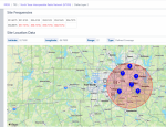
Yes, there's a distance setting. It's not an exact thing but will let you have some control over what you're hearing.

Page 22
 

bearcat

Member
Joined
Dec 24, 2002
Messages
734
I presume you are at a fixed location and using coordinates or zip code for your location and your "travel" is local.
Yep, I have about 20 or so manually programmed LAT/LON locations in the radio for places I frequently visit. Works nicely
 

shansmi

Member
Premium Subscriber
Joined
Aug 20, 2022
Messages
133
Range is based on the transmit "range" of the system set in the database, your set location (zip code or GPS) and seeing if the 2 overlap.

Example, you are 60 miles away from a transmitter and the range in the database 50 miles. You set the range (under location) to 15 miles. The radio will try to listen to that transmitter 50 + 15 = 65. That does not mean you will hear it, just that the radio will scan it.


Wow. the Range (and location) can only be seen in the main database (premium subscription not required) i.e. not in Sentinel.
 

hiegtx

Mentor
Premium Subscriber
Joined
May 8, 2004
Messages
11,193
Location
Dallas, TX
Wow. the Range (and location) can only be seen in the main database (premium subscription not required) i.e. not in Sentinel.
That's somewhat misleading.

In the database, online, if you select a trunked system, then select a site, you will see a page with location & range details.

For this screenshot, I was using a browser I don't commonly use, and was not logged in, so what I can (or can't) see is the same as a non-Premium would see..
1665954728214.png
Now, I'll click on a site.
1665954876898.png
I get the message that I cannot see the Channel ID Tables because either I am not a Premium Subscriber, or am not logged in. (The 'not logged in' applies here.)
However, below that section, I can see the location & range details for the site, regardless of Premium or logged in state.
1665955115119.png

For Departments in Conventional systems, regardless of logged in status when viewing the Database online, Premium or non-Premium, if you click on the license field for the channel (assuming the license is linked), you get only the details as what is on the FCC license. Frequencies & locations of the transmit towers, but no range nor of the location (which, for the database, is basically the jurisdictional area where that channel is used).

For Departments in a trunked system, no location details (latitude/longitude, nor range) are available online, again regardless of whether you are, or or not, a Premium subscriber, and if Premium, when you are logged in.

You are correct in that, when using the main (initial) screen of Sentinel, location & range locations are not visible. However, in Sentinel, if the Favorites list editor is in use, you can see location (latitude/longitude) as well as range settings for any trunked system site, a Department on a trunked system, or a Department that is within a conventional channels system.

Department of a Conventional system in the Sentinel Favorites Editor:
1665956417388.png
Site of a trunked system (in the Favorites Editor):
1665956526170.png
Department from a trunked system (also in the Editor).
1665956600929.png

If you wanted to review location details for a conventional system's Department, or a Department (or Site) from a trunked system that is not currently in one of your Favorites lists,, you could simply append it (temprarily) to either one of your existing lists, or create a 'dummy' list so that you can review the details. Ornce your review is complete, then either delete your 'dummy' list, or delete the system from your existing list (if you don't plan to use it at this time).
 

hiegtx

Mentor
Premium Subscriber
Joined
May 8, 2004
Messages
11,193
Location
Dallas, TX
The 12, 16 & 32, are those mileage numbers or a random number relevant to signal strength?
The ranges used in the RadioReference database (which is part of the information Uniden uses to create the database for use in Sentinel) are based on details for the system, and usually are set to cover the area the system (or site) is expected to cover. In many cases, the system might also be strong enough to be received much farther, but the ranges used are based on how much distance is needed to cover the agency. For example, the 16 mile range setting for the Dallas Fire Dept. above would cover all portions of the city. The Latitude/Longitude figures would be a rough center-point of that coverage area.
 

garys

Member
Premium Subscriber
Joined
Jun 13, 2002
Messages
6,092
On my self built systems and departments, I spend a fair amount of time fiddling with range settings in order to optimize coverage to suit my needs.

Are you doing that with Sentinel?

The ranges used in the RadioReference database (which is part of the information Uniden uses to create the database for use in Sentinel) are based on details for the system, and usually are set to cover the area the system (or site) is expected to cover. In many cases, the system might also be strong enough to be received much farther, but the ranges used are based on how much distance is needed to cover the agency. For example, the 16 mile range setting for the Dallas Fire Dept. above would cover all portions of the city. The Latitude/Longitude figures would be a rough center-point of that coverage area.
 
Top