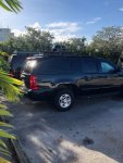
now i realize its a long video and not terribly good quality or of high production value, but i do describe the tag starting at 2:10 mark. I ALSO typed up the description as the text for the video, from youtube:
Published on May 2, 2011
spotted on Hwy 1 north approaching 440 belt line. this is very near where most of the tornado damage occurred, but take note of the big dome, AWACS style and other odd assorted antennas.
plate was strangely generic even for govt type. plain white with blue letters. top reads U.S. GOVERNMENT in small letters. tag number is 1149. that's it. nothing more. sorry video quality is bad but the only cam i had i could reach at the time. anyone know what this is? I just am really curious cause i haven't the slightest clue
now i recall, possibly incorrectly, that it was one of the newer style plates, similar to the following link but without the "for official use only" part at the bottom with 1149 centered.
Google Image Result for http://www.plateshack.com/y2k/US_Government/usgovsgtatarms.jpg
a quick search doesn't result in seeing any of the new style font in that configuration, minus the FOUO that is. so odds are it was one of the older style ones, such as the following link, with 1149 centered
Google Image Result for http://dcplates.com/assets/GovUS15a.jpg
now with all of that settled, possibly, what crucial identifying detail of the
tag is still needed to identify the
Dome/usage/user?


