Calculating radio Horizon

Status
Not open for further replies.

davenlr

Member
Premium Subscriber
Joined
Jan 31, 2014
Messages
638
Location
North Little Rock, Ar
I have used the various calculators online to generate a radio horizon chart, but they are all based on both stations being on level ground, with no hills, and apparently, all at the same altitude.

I failed geometry, and never took calculus, so I dont even know how to go about doing this...but if someone is good at math, and can help out, I am all ears....

Here are the specifics.

Station A. 450' ASL, 30' antenna height, 1090 Mhz operating frequency. Ridge at 550' ASL at 1 mile from station A, blocking signals approx 2 to 5 degrees from horizontal.

Station B, 259' ASL, 40,000' antenna height (airplane), 1090 Mhz operating frequency

Now I know because of the ridge, the "line" to the horizon is tilted up about 2 degrees or more if I point at the top of the hill. This would cause a "shadow" area behind it. What I need to figure out, is if I am not pointing at the horizon, but instead pointing 2 degrees above the horizon (to clear the hill), at what distance would a receiver at 40,000 feet no longer be in the site of the antenna, but would be in the shadow area of the hill?

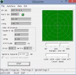
Using real world testing, the calculator shows the distance to be 253 miles. In reality, I am getting about 120-150 miles.

What I am trying to determine, is if that range (120-150) is the actual radio horizon, or if a higher gain antenna would improve this range.

Station A is using a 1/2 wave dipole (coaxial), with 50' of LMR400 coax. Receiver RF gain set at max (49.5db) to obtain the highest data rate.
 

popnokick

Member
Premium Subscriber
Joined
Mar 21, 2004
Messages
2,840
Location
Northeast PA
Maybe I'm misreading or misunderstanding something here but..... 120-150 miles on 1090 mHz with a 1/2 wave dipole? On the earth, or is this for earth to space satellite comms?
 

davenlr

Member
Premium Subscriber
Joined
Jan 31, 2014
Messages
638
Location
North Little Rock, Ar
Earth to aircraft data comms.

Here is a snip of one of the data comms:

N775AN AA7BA7
American Airlines AAL70
United States Civil
Boeing 777-223 B772

Altitude:
33775 ft

Vertical Speed:
768 ft/m

Speed:
672.1 mph

Heading:
59.1°

Distance:
117.87 mi

Squawk:

Engines:
Twin jet

Species:
Landplane

Wake Turbulence:
Heavy

Route:
KDFW Dallas Fort Worth, Dallas-Fort Worth, United States
EDDF Frankfurt am Main, Frankfurt-am-Main, Germany
 

popnokick

Member
Premium Subscriber
Joined
Mar 21, 2004
Messages
2,840
Location
Northeast PA
OK, the context now all makes sense. So assuming the simplest thing to do is use a better antenna with some gain.... which is going to improve the situation regardless... and at the lowest cost... what would you do instead of a better antenna? Better coax? Receiver preamp (might introduce noise)? Cut away some of that mountain? Trying to figure out why your first step would NOT be a better antenna.....
 

davenlr

Member
Premium Subscriber
Joined
Jan 31, 2014
Messages
638
Location
North Little Rock, Ar
Because the dipole is homebrew and works pretty well, and the better antenna is $140 and there are no guarantees it will work better :) The gain antenna has a much lower angle of radiation, hence I might just be looking into the side of the hill, and get worse reception/more noise. I built a collinear 6db gain antenna, and it performed worse than the coax dipole I am using now.

I was just more curious than anything, about how to calculate the radio horizon when close in hills come into play. Im thinking my current reception is probably maxed out. Im already using the best coax I can, short of hardline, which would be overkill for this. Its just an experimental hobby setup using a $20 European TV tuner stick. I just like learning about new stuff. When I run into a question I cant find an answer for, it bugs me for a long time :)
 

AirScan

Member
Joined
Feb 13, 2007
Messages
2,860
what distance would a receiver at 40,000 feet no longer be in the site of the antenna, but would be in the shadow area of the hill?

Consider that the "line of sight" distance would be the same thing as the "shadow area" blocked by an obstruction.

The hill is 70 feet above the antenna.

Therefore the shadow area blocked by the hill = 11.8 statute miles (1.4145 times the square root of 70).

The hill is 1 mile from the antenna.

Therefore the shadow area behind the hill from the antenna = 11.8 - 1 = 10.8 miles.

This 10.8 mile "shadow area" penalty would apply to an aircraft at any altitude from the antenna.
 

AirScan

Member
Joined
Feb 13, 2007
Messages
2,860
So I would subtract the 10.8 miles from the calculators 253 miles?

How did you get 253 ?

An aircraft at 40,000 feet (asl) is 39,550 feet (agl) (elevation at antenna).

The antenna is 30 feet (agl).

Line Of Sight Calculator

Line of sight = 289 miles.

Subtract 10.8 from 289 = 278.2 miles
 

N0IU

Member
Joined
Sep 26, 2009
Messages
802
Location
Wentzville, Missouri
The gain antenna has a much lower angle of radiation, hence I might just be looking into the side of the hill, and get worse reception/more noise.

Maybe I don't understand the question, but what does the angle of radiation have to do with anything? You are only using the antenna to receive so the antenna is not radiating anything.

I built a collinear 6db gain antenna, and it performed worse than the coax dipole I am using now.

Maybe, just maybe there is a problem with the way you built the antenna. I built one for my Virtual Radar setup and it works great! I was very careful to make sure that the center conductor was not shorting out against the outer shield where the sections are joined together and at the connector.
 

davenlr

Member
Premium Subscriber
Joined
Jan 31, 2014
Messages
638
Location
North Little Rock, Ar
Anything is possible. The one I built was not the "coax" version, it was the 1/4 wave under two 5/8 wave version. It worked, actually all the antenna's I have tried worked, they all just cut the planes off at about 70 miles going East, where they work out to 150-200 miles north, west and south.

Since the ridge is 1 mile east of me, I was just trying to figure out what range to expect, so if I had a mathematical formula, I could plug in numbers of higher antenna height, to see if maybe an additional 20' would get me out 150 miles to the east. If I had to go up an additional 100' to do it, it just would not be cost effective.

As for angle of radiation, if the antenna has all its gain at 0.5 degrees, even if its receiving only, that means it would have very little gain, or a loss, at 5 degrees. Same reason a 1/2 wave dipole is much more useful for short range comms on 40 and 80 Meters than a vertical. The vertical shoots the signal right over the close in stations, but excels out at the long ranges.

My UHF TV antenna even has a beam tilt setting, which I use to raise the forward end of the antenna so it points at the top of the ridge, rather than directly into it. Improved my TV signals quite a bit.
 

W3DRM

Member
Premium Subscriber
Joined
Mar 9, 2004
Messages
10
Location
Emmett, Idaho
For those of you who want to view the actual charting of obstacles around you, you might want to try a program that will plot radio coverage based on your altitude and the surrounding terrain. It's not designed for line of sight coverage relative to aircraft but I suspect it could give you a good indication of terrain that may be blocking your reception in specific quadrants around your antenna location..
Be aware this is a pretty sophisticated package and isn't a simple plug-n-play item. It will take time for anyone to learn to use it.

Hope this helps folks wanting to know their radio coverage questions.
 

morfis

Member
Joined
Jan 24, 2004
Messages
1,645
Station A. 450' ASL, 30' antenna height, 1090 Mhz operating frequency. Ridge at 550' ASL at 1 mile from station A, blocking signals approx 2 to 5 degrees from horizontal.

Station B, 259' ASL, 40,000' antenna height (airplane), 1090 Mhz operating frequency

A ridge a mile away and 70' higher than your aerial you will see next to no difference in reception from an aircraft at 40,000' if you removed the ridge (ie. added 70 feet of mast).
This situation is less than 1 degree above horizontal, not 2 to 5 as you state. Realistically, the theoretical horizon for your aircraft at 40,000' is around 280 miles. At around 280 miles an aircraft at 40,000 would be 'visible' to your aerial but lower aircraft wouldn't be. You could draw a scale diagram of this to see the blind area/height you'd first resolve aircraft based on this.

You might benefit from a mast-head preamp and using less gain on the 'dongle' - you want to amplify the signal at the aerial and not the noise collected enroute from the aerial to your computer.

How is Station B 259' ASL if it's at 40,000'?

Sounds to me more like your receiving system is the limiting factor here and not any theoretical line of sight from the aircraft.

With a DVB-T stick and it's stock aerial on a tin lid on my windowsill I get aircraft up to around 150 miles away at cruising altitudes. I have the gain set around 30 (any higher and the decode rates drop). With a dedicated MODE-S/ADS-B receiver and tuned aerial I get more decodes and a range around 240 miles. Mount the aerials ten feet higher up (ie just above my roof) and I get better all round reception but negligible difference in maximum range.

The software referenced above is great if you want to map things like repeater coverage in an undulating terrain but of no practical use for the situation you describe here. Also be aware it requires a huge amount of data to be downloaded. There are several tools that will show paths and actual terrain profile between two points for the UK but I haven't seen a US version
 

davenlr

Member
Premium Subscriber
Joined
Jan 31, 2014
Messages
638
Location
North Little Rock, Ar
Well, Ive been watching the plots for the past several days, and it consistently gets aircraft out to 150 miles in 3 directions (NNW, W, and SW). I can hear the aircraft talking to center to the east, but they dont show up, or drop off the radar at 50 miles. Every single one of them. I have tried the antenna in different places on the roof, but the plots remain pretty constant. I just got a terrain map emailed to me, and I am at 380'. Antenna is 30' higher. Ridge to east is 550'. So its more like 550-(380+30).
I get good decode rates, always between 380 and 450 frames per second.

I ordered a DPD antenna (9 dbi gain), and will mount it another 10' higher than the current one when it comes in. That will be the best I can do.

For reference, a plane flying from due North across eastern Arkansas is visible to me now from about the Louisiana boarder until it gets to about due SW, then it drops off, but will pop back up when its due NE of me. Same thing happens when a plane is coming into the Little Rock airport. Ill get it to the east OK, until it gets to about 1500', then it will drop out, but when it gets more to the south at about 700', Ill pick it up again.

Hopefully the added gain+height of the DPD antenna will help.

To the question posed, the aircraft at 40,000' is over flat terrain that averages 259' ASL.
 

morfis

Member
Joined
Jan 24, 2004
Messages
1,645
Your revised height gives us an angle of 1.5 degrees...and for an aircraft at 40,000 feet only a midges dangly difference in distance (as in a couple of miles in 280 miles).

The 'average' 259' land is also insignificant in the 'nominal' 40,000'

Here in the UK 450 decodes a second would be poor.....1090MHz is fairly saturated here!

Visited Little Rock a couple of times - both flying visits rather than an opportunity to admire the area. Tomorrow I'll have to look at the actual terrain.

Which software are you using to plot the aircraft? Usually seem to find that people in the US prefer different software to that used over here for most things scanning-related.
 

737mech

Member
Premium Subscriber
Joined
Aug 14, 2006
Messages
2,443
Location
Clark County, NV.
Well, Ive been watching the plots for the past several days, and it consistently gets aircraft out to 150 miles in 3 directions (NNW, W, and SW). I can hear the aircraft talking to center to the east, but they dont show up, or drop off the radar at 50 miles. Every single one of them. I have tried the antenna in different places on the roof, but the plots remain pretty constant. I just got a terrain map emailed to me, and I am at 380'. Antenna is 30' higher. Ridge to east is 550'. So its more like 550-(380+30).
I get good decode rates, always between 380 and 450 frames per second.

I ordered a DPD antenna (9 dbi gain), and will mount it another 10' higher than the current one when it comes in. That will be the best I can do.

For reference, a plane flying from due North across eastern Arkansas is visible to me now from about the Louisiana boarder until it gets to about due SW, then it drops off, but will pop back up when its due NE of me. Same thing happens when a plane is coming into the Little Rock airport. Ill get it to the east OK, until it gets to about 1500', then it will drop out, but when it gets more to the south at about 700', Ill pick it up again.

Hopefully the added gain+height of the DPD antenna will help.

To the question posed, the aircraft at 40,000' is over flat terrain that averages 259' ASL.

Did you run sbsplotter on the current antenna?
 

davenlr

Member
Premium Subscriber
Joined
Jan 31, 2014
Messages
638
Location
North Little Rock, Ar
Which software are you using to plot the aircraft? Usually seem to find that people in the US prefer different software to that used over here for most things scanning-related.


Using a DVB-T dongle with the recommended sensitive chipset, ADSB#, and Virtual Radar.
 

737mech

Member
Premium Subscriber
Joined
Aug 14, 2006
Messages
2,443
Location
Clark County, NV.
Never heard of it, I just downloaded it, but when I click start, it doesnt do anything at all. Do I need to run it all by itself, without the ADSB# program running?

No you need VRS running. You'd have to go into options and setup a rebroadcast server, pretty easy to do. Use the "Basestation" format out, set port to 33001. Then enter in the sbsplotter boxes the port number 33001 and the 127.0.0.1 for IP BS then your lat and longs. Click start watch it plot. That will give you a visual reference to your antenna range.
 
Last edited:

davenlr

Member
Premium Subscriber
Joined
Jan 31, 2014
Messages
638
Location
North Little Rock, Ar
Ok, I did that. SBS Plotter sitting there with a green dot flashing next to Port, but at the bottom it says
Msg rate 0/sec total msgs:0. The server is showing messages coming in like crazy, and there are aircraft on the map.
 

Attachments

  • ul1.jpg
    ul1.jpg
    32.6 KB · Views: 569
  • ul2.jpg
    ul2.jpg
    54 KB · Views: 562

davenlr

Member
Premium Subscriber
Joined
Jan 31, 2014
Messages
638
Location
North Little Rock, Ar
Ok, I figured it out. I needed to enable UPnP When I try to save the file, it says directory not found. They really need some instructions with this program :) Its doing its thing, but dont know how Im going to save it. Autosave wont check on either.
 
Last edited:
Status
Not open for further replies.
Top