How accurate/up-to-date are the ARTCC freqs in the RRDB? And...

Status
Not open for further replies.

linanbob

Member
Joined
Sep 29, 2013
Messages
14
is there an authoritative (e.g. FAA documents) map/list of sectors and frequencies?

I've looked at the current low and high altitude IFR enroute charts, and there are boxes containing names and frequencies of remote radio sites included. But...

1. There are many instances where the charts specify sites that don't appear as an RCAG in the RR database.
2. There seem to be good numbers of additional frequencies in the RR database that don't appear in the charts.

For one example, RR lists a ZKC RGAG in Vandalia IL (that one can see on Goog maps) with a VHU/UHF frequency pair, but I can't find any reference to a Vandalia remote radio site in the charts.

I also get hits on the scanner on freqs that the RRDB tells me are a good 150 miles away. I understand that's the base and not the aircraft, and if the sector is big enough, the aircraft can be relatively close. (Which explains my interest in the sector maps.)

In my ideal world, I'd like to look at sector maps to give me an idea of what I could reasonably expect to hear, then set up the scanner appropriately. I could do it the hard way, and try and track planes as they depart, and see what freqs they get assigned, but that only works at home.

I apologize in advance for questions that have to have been asked in different forms, but haven't found much by searching here or on the 'net generally.
 

AirScan

Member
Premium Subscriber
Joined
Feb 13, 2007
Messages
3,026
is there an authoritative (e.g. FAA documents) map/list of sectors and frequencies?

I've been looking for years and have never found one. The only way I know how to obtain them is to contact each individual ARTCC facility directly and ask them for either their sector maps or a copy of their standard operating procedures. In most cases this requires submitting an FAA FOIA Request before they will give them to you.

For one example, RR lists a ZKC RGAG in Vandalia IL (that one can see on Goog maps) with a VHU/UHF frequency pair, but I can't find any reference to a Vandalia remote radio site in the charts.

There are many RCAG sites and frequencies that are not shown on the aeronatical charts. The RR ARTCC Database is the best reference I'm aware of, but relies on volunteers to keep it updated. Still better than the FAA, but they seem to be getting better.

In my ideal world, I'd like to look at sector maps to give me an idea of what I could reasonably expect to hear, then set up the scanner appropriately.

You can find some ARTCC sector charts on the Center wiki pages in the RR Database. For example here is what they have for Kansas CIty/ZKC. It's a little out of date but mostly accurate AFAIK.

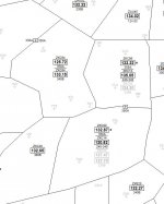
I've put together my own charts for the high altitude sectors. You can download them off the LiveATC ARTCC Forum. Look for posts titled "High Altitude Charts" by JetScan1. Sector boundaries are based off official charts and frequencies updated from personal monitoring. If you want PM me and I can e-mail you coverage of a specifc area. Eg:


ZKC EG.jpg
 
Last edited:

Whiskey3JMC

Just another lowly hobbyist
Premium Subscriber
Joined
Jul 16, 2006
Messages
7,805
Location
Philly burbs 🇺🇸
1. There are many instances where the charts specify sites that don't appear as an RCAG in the RR database.
2. There seem to be good numbers of additional frequencies in the RR database that don't appear in the charts.
First and foremost the RRDB relies on user submissions to stay up to date. When changes occur via other sources there's no "automatic update" to reflect said changes in the RRDB. Users make submissions & database is updated accordingly
 

linanbob

Member
Joined
Sep 29, 2013
Messages
14
I've put together my own charts for the high altitude sectors. You can download them off the LiveATC ARTCC Forum. Look for posts titled "High Altitude Charts" by JetScan1. Sector boundaries are based off official charts and frequencies updated from personal monitoring. If you want PM me and I can e-mail you coverage of a specifc area. Eg:
Had a look there, thanks. Didn't see a ZKC. If what you have is newer than 2009 (which is what the RR wiki has) I'd certainly appreciate a copy. Thanks much. DM on the way.
 

silagi

Member
Joined
Apr 24, 2008
Messages
117
Location
Fremont, CA
is there an authoritative (e.g. FAA documents) map/list of sectors and frequencies?

I've looked at the current low and high altitude IFR enroute charts, and there are boxes containing names and frequencies of remote radio sites included. But...

1. There are many instances where the charts specify sites that don't appear as an RCAG in the RR database.
2. There seem to be good numbers of additional frequencies in the RR database that don't appear in the charts.

For one example, RR lists a ZKC RGAG in Vandalia IL (that one can see on Goog maps) with a VHU/UHF frequency pair, but I can't find any reference to a Vandalia remote radio site in the charts.

I also get hits on the scanner on freqs that the RRDB tells me are a good 150 miles away. I understand that's the base and not the aircraft, and if the sector is big enough, the aircraft can be relatively close. (Which explains my interest in the sector maps.)

In my ideal world, I'd like to look at sector maps to give me an idea of what I could reasonably expect to hear, then set up the scanner appropriately. I could do it the hard way, and try and track planes as they depart, and see what freqs they get assigned, but that only works at home.

I apologize in advance for questions that have to have been asked in different forms, but haven't found much by searching here or on the 'net generally.
You can make a Freedom of Information Act (FOIA) request with the FAA and request a copy of the most current version of the Standard Operating Procedures (SOP) for the ATC facility that you are interested in. This document will include sector maps and frequencies. For example in the Bay Area where I live, I requested the SOP's for Oakland Center (ZOA) and Northern California TRACON (NCT). The SOP document number is the same for all facilities. You just change the prefix in front of the number. For example:

NorCal TRACON: "NCT 7110.65"
Oakland Center: "ZOA 7110.65"

I request that it be sent in digital form (PDF) and they send a CD in the mail for free. They may or may not charge for a printed version. I have never requested a paper version.
 
Status
Not open for further replies.
Top