Cleveland National Forest New Forest Net

zz0468

QRT
Banned
Joined
Feb 6, 2007
Messages
6,034
The centroid shows something rectangular along the hiking trail but I don't think it is a repeater as I would expect some solar panels.

33°35'17.6"N 117°26'29.9"W

In the image there is something white and sort of pole shaped down and left about 40 feet away

Looking at older views, that white thing down and left appears to change locations a number of times. I'm not sure what it is.
 

zz0468

QRT
Banned
Joined
Feb 6, 2007
Messages
6,034
Try this in Google Earth, looks like there is buildings and antennas [more to the west of your location]
Lat 33.587222
Lon -117.446111

Had to get close as it looks like Foot/Mule only access :)

Ok, so that's the actual "Sitton Peak". I see a rock outcropping there, but no buildings/antennas.
 

ecps92

Member
Joined
Jul 8, 2002
Messages
14,414
Location
Taxachusetts
Sitton Peak itself is alittle more North.

From GE, it appears there is something at the Lat/Lon I posted, but we can't zoom in much more.
Could be wrong, but certainly looks like something on the Rocks
11SMT5860316479
Ok, so that's the actual "Sitton Peak". I see a rock outcropping there, but no buildings/antennas.
 

Teotwaki

Member
Joined
Aug 3, 2008
Messages
417
Location
SoCal
I was able to spend a few hours today out in the field looking for clues about the Sitton Peak site.

First off, I found a site I did not know of located right here 33°30'09.6"N 117°36'06.5"W

It is not the Sitton Peak repeater site but seems to house a number of radios. It's hard to get pictures of the tower as it is set back a ways from Highway 74. The site also hosts FM station KSBR-FM Mission Viejo
 

Teotwaki

Member
Joined
Aug 3, 2008
Messages
417
Location
SoCal
The coordinates you posted correspond to a site called "Ortega" in the KMZ file posted earlier, so I'm not sure what's what. The actual "Sitton Peak" is obviously not the location of the CNF repeater.

The "Ortega" site is, I believe, a Riverside County PSEC site. The curious thing is, the KMZ file shows both Ortega and Sitton.

You are correct that the Ortega site includes a RivCo PSEC location. Today I confirmed it had a comms shelter, a 100' tower, 6 GHz microwave link pointing SW, two panel antennas and two omni sticks

DSC_9462-2.jpg
 

Teotwaki

Member
Joined
Aug 3, 2008
Messages
417
Location
SoCal
Regarding "Sitton Peak". It can be heard in Orange County so it has some decent elevation. Today I took a handheld radio and terminated the antenna into 50 Ohms and drove Ortega Highway. Received some super strong hits near the San Juan trailhead and also in the pullouts near the Ortega Falls trailhead. When the FS units unkeyed the repeater it had a very minimal carrier hang time.
 

allend

Member
Premium Subscriber
Joined
Feb 1, 2012
Messages
1,378
Location
Long Beach, CA
Regarding "Sitton Peak". It can be heard in Orange County so it has some decent elevation. Today I took a handheld radio and terminated the antenna into 50 Ohms and drove Ortega Highway. Received some super strong hits near the San Juan trailhead and also in the pullouts near the Ortega Falls trailhead. When the FS units unkeyed the repeater it had a very minimal carrier hang time.

Cool Stuff. Now I know where Blue Jay Campground is because I have been mountain biking up there before. What frequencies are part of this radio tower in regards to the USFS and other stuff maybe but as well know PSEC is nothing in the clear. Everything is locked down on that site
 

zz0468

QRT
Banned
Joined
Feb 6, 2007
Messages
6,034
I was able to spend a few hours today out in the field looking for clues about the Sitton Peak site.

First off, I found a site I did not know of located right here 33°30'09.6"N 117°36'06.5"W

It is not the Sitton Peak repeater site but seems to house a number of radios. It's hard to get pictures of the tower as it is set back a ways from Highway 74. The site also hosts FM station KSBR-FM Mission Viejo

It's an SCE site called Ortega Hill.
 

zz0468

QRT
Banned
Joined
Feb 6, 2007
Messages
6,034
You are correct that the Ortega site includes a RivCo PSEC location. Today I confirmed it had a comms shelter, a 100' tower, 6 GHz microwave link pointing SW, two panel antennas and two omni sticks

View attachment 67133

Yeah, it just looks like a PSEC site, and I know they wanted one in that general area. The mw link probably goes to Santiago Peak, but that would actually be to the NW.
 

zz0468

QRT
Banned
Joined
Feb 6, 2007
Messages
6,034
Found a cell site near the general area of the Candy Store. 33°37'12.13"N 117°25'13.68"W
 

krazybob

Member
Joined
Oct 26, 2003
Messages
481
Location
Lake Arrowhead, Southern California
Regarding "Sitton Peak". It can be heard in Orange County so it has some decent elevation. Today I took a handheld radio and terminated the antenna into 50 Ohms and drove Ortega Highway. Received some super strong hits near the San Juan trailhead and also in the pullouts near the Ortega Falls trailhead. When the FS units unkeyed the repeater it had a very minimal carrier hang time.
El Cariso is at the top of Ortega Highway just before it starts dropping down on to the west side of Lake Elsinore known as Lakeland Village. The El Cariso Hot Shots are located there at Camp 23 as well as the Wildland Firefighters Memorial. The El Cariso site you're thinking of sits approximately 1.5 miles South of Highway 74. It is a known US Forest Service site and it appears on the original list I provided.

My daughter lives in Fallbrook and I regularly use Ortega Hwy to get over to the 15 when I'm stuck on the 405. I get off in San Juan Capistrano and shoot straight across east. My eyes are always open for radio sites no matter where I drive.

After converting the lat long Teotwaki gave I came to the same location as he did. KSBR-FM, which is actually two pads. I am intrigued by ksbr because it does not appear in my database. I had to do some digging to come up with licensees that include Fox Television Studios, Nextel, numerous contractors, numerous water districts throughout Southern California and what appeared to be GMRS repeaters.

If it's helpful, remember that what one licensee refers to as the lat long another licensee uses a different set of numbers to refer to the same location. They are just standing in different spots. Or they're getting the lat long from the tower provider which may not be the owner. My main repeater site for example is listed at 6200 and some odd feet but yet when you stand there right underneath the tower in the middle you are at 6489 feet. The point I'm making is it all depends on who you ask.

As we all know, sites often times go by names other than what we expect. What the Forest Service refers to as a site name, Cal Fire, as I'll show you in a moment, refers to as another. Some sites, such as the backup repeater location for my repeaters, don't require registration with the FCC and you won't find them by the site name.

ksbr.jpg


As I did licensee searches I noted that what Cal Fire refers to El Cariso the Forest Service refers to as Ortega. There is never any mention of Sitton Peak other than the image that you snatched off of Google. Your dummy load test confirms that as you approached Ortega Falls you received a stronger signal. That's El Cariso - Ortega.

I don't routinely monitor the Cleveland. I can tell you that in the San Berdu's the repeaters are set for a near instant timeout. Most radio traffic on Forest Net is on talk-around. Most traffic on Admin is on the repeater.

El Cariso (RRU) USFS (Ortega)

cariso-ortega.jpg


Sent from my SM-G965U using Tapatalk
 

zz0468

QRT
Banned
Joined
Feb 6, 2007
Messages
6,034
In reviewing the thread, I missed a few things here.

If you know it's wrong then cite your source.

I'm the source. 35+ years professional experience, building and maintaining sites for various entities in the Angeles, San Bernardino, and Cleveland national forests, as well as desert areas. I get around a bit.

The specific problem I have with you, ZZ, you quote in sections and then say it's wrong but don't say what the correct information is.

Actually, I do. Go back and re-read my posts. If I see something in error, I so state, and state the correct data.

You stalk me from topic group to topic group and always make sure to insert comments attempting to state that I'm wrong but seldom give anything of technical value.

We seem to have a common interest in sites and systems in the local area. How about that.

Let me begin with the fact that the Forest Service system is fully capable of simulcast repeater operation. But they do not use it that way.

This is not correct. My source: my eyes. I frequently find myself at sites with USFS radios for the systems we're currently discussing. They lack the required full duplex links, and precision frequency references., They are typically a stand alone Daniels repeater and duplexer. There is no link to bring status tone and audio for voting. There is no link for simulcast transmitter control. It simply isn't there at any of the USFS occupied sites that I've ever been to. I'm not sure what the source of YOUR information is.

If you know anything about simulcast,
you know that there is overlapping coverage area in which signals that produce a wah wah wah sound.

A properly designed and aligned simulcast system does NOT go "wah wah wah". Great pains are taken to insure that they don't. Simulcast requires precise control of transmitter frequency, audio frequency response and levels, and precise timing of audio "launch delay". The end result is,, usually, listeners being unable to tell that they're listening to multiple transmitters.

The "wah wah wah" sound is the result of multiple transmitters on the same frequency but otherwise unsynchronized, such as what the USFS uses.

When they are slightly out of phase it's even more pronounced. How do I know? Because I run numerous repeaters that are in simulcast mode. How many do you run?

The actual number is in the hundreds, but alas, none of them are in the ham band.

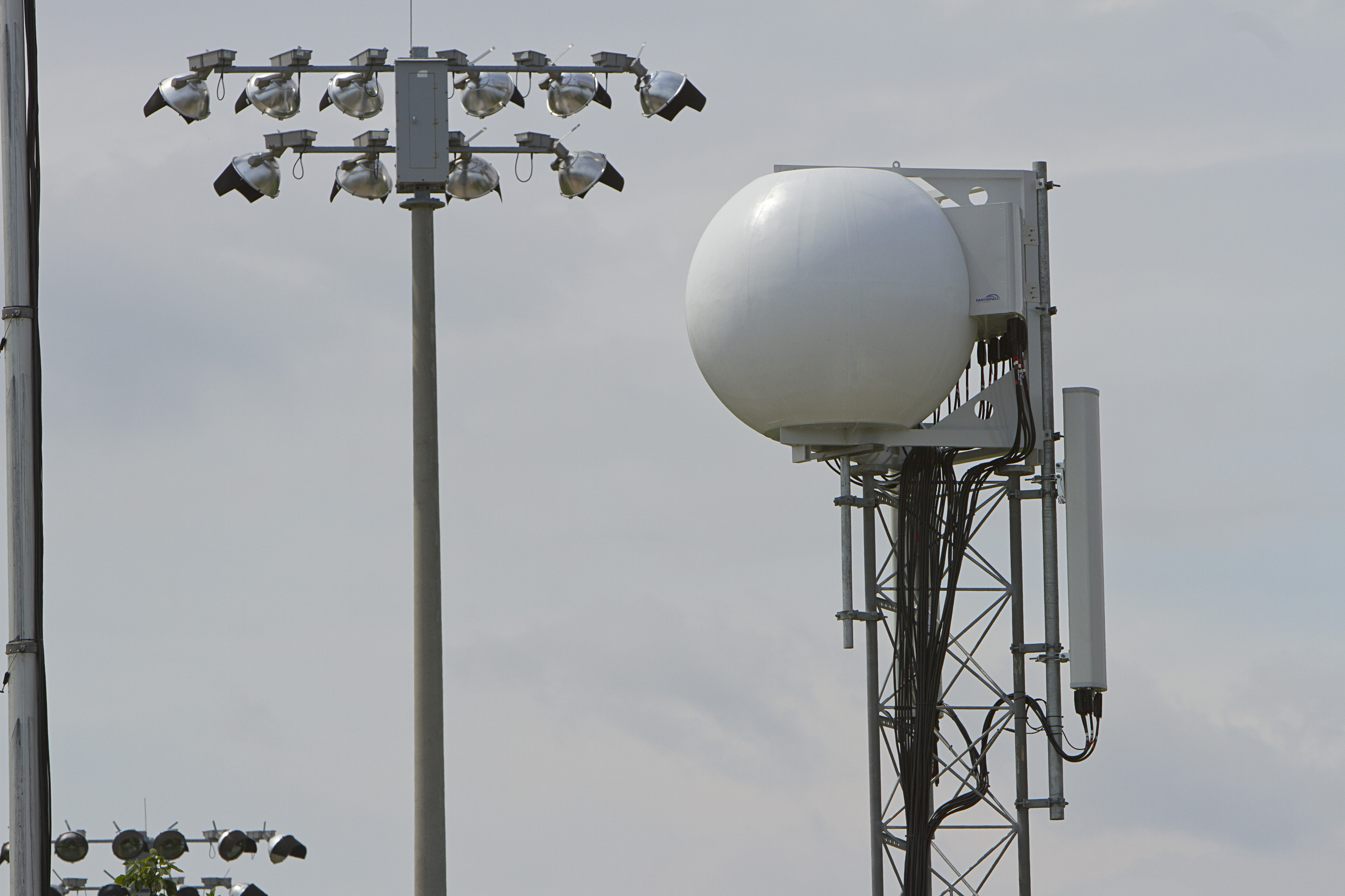
Do you know what a Spectra-Tac voter is? The Spectra-TAC Total Area Coverage Comparator is a nice device.

Indeed it is. As is the Astro-Tac, Digi-Tac, and the JPS voter. I've designed and built systems using them all, Bob. I am quite familiar with receiver voting.

They do not use tone select transmitter steering. If they did the dispatcher would not tell them to come up on a specific tone or they would not tell the dispatcher the time that they are on. Unless know the area that they are in and use that tone.

But that's exactly what they're doing when they refer to a repeater as "Tone 4" or whatever. C'mon, Bob. You hear them say that all the time. That's how they tell each other what repeater to use. If one uses tone 4 and the other uses tone 3, you get the "wah wah wah" sound, because the repeaters are on the same pair, but completely unsynchronized. That, specifically, is NOT what simulcast is.

When they change tones it comes in on the dispatchers console and they press the transmitter button next to it. Or they press Select and use the large transmit button on the Centracom. You'll tell me I'm wrong but you won't tell me how. That means you're speculating.

The consoles key a control station. The console can select tones, typically what they do is send an audible tone from the consolse to the control station. A tone panel at the control station decodes the audible tone, and replaces it with a subaudible tone at the control station transmitter. It's done this way because PL can't easily or cheaply be sent over wirelines, or microwave circuits. So, the end result is operator selection of PL tone transmitted from their control station to the selected repeater. The mobiles simply change modes to one on the same frequency pair and labeled with the desired tone. Forest Net tone 1, and Forest net tone 2 would occupy two modes in the radio, and is how the mobile selects the proper tone. The dispatcher calls someone and states "on forest net tone 3", and the mobile selects tone 3 on his radio, and they communicate through the same repeater.

If there's sufficient overlap, one could be on tone 1, and the other could be on tone 3, but you'd hear "wah wah wah" when both repeaters key up at the same time. It's a frequent occurrence.

My source is me. I've built and maintained such systems for various wildfire agencies. That's how they do it, Bob.

...That means that if two transmitters key up at the same time, which they would not do on tone select transmitter steering...

But they CAN and they DO get keyed up at the same time. It goes "wah wah wah".

which would steer the signal to one transmitter based on the voted receive of the station calling, I can often hear it. You write that you weren't sure if they even use voting. You aren't sure but I'm wrong? How then would transmitter steering work?

Yep. I know they use tone select transmitter steering. I see no evidence that they use receiver voting. Tone select transmitter steering works just fine with no voters.

Transmitter steering works based on a voted signal that tells the system which site to steer to automatically. The Forest Service radio system like the Cal Fire radio system is based on a honeycomb network of transceiver sites. They can operate in repeater mode, simulcast mode, and talk-around. Their normal mode is talk around.

Cal Fire doesn't use simulcast.

My source: Me. I know that system.

CHP uses transmitter steering. It's specifically uses voting.

CHP predominantly uses simulcast. My source: Me. I've seen that system, and stood in front of their transmitters that say "simulcast component. Make no adjustment unless in contact with technician at..." I told you this several years ago in another thread when you were posting as tomasG. It's a sticky that you can still easily find.


The CHP officers don't manually change the tone. The system automatically votes which receiver has the best signal to noise ratio and steers the transmitter closest to the officer on the assumption that if he's best heard coming in on a particular receive site he will best hear the dispatcher on the same location. I can be listening to Santa Ana in particular and they are loud and clear. Suddenly they get a unit down south of Loma Ridge on the south side of the Santiago mountain range and I can barely hear them. That's transmitter steering. Fully automated transmitter steering.

Yes, there is some automatic transmitter steering in the CHP system. It's a mix, depending on the specific channel.

Hearing simulcast sites is actually the curse of living at this altitude. When two transmitters key up it sometimes makes the signal difficult to copy.

It can be, and I don't envy you that. Simulcast systems are designed for the users coverage area, not scanner listeners.

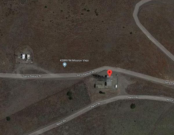
I did not say Ranger Peak. I said Ranger. That is the FCC name. It is a 101 foot self supporting tower at 5085 ft ASL. It is 6 miles Southeast of Banning. It is Northwest of the Vista Grande Forest Service fire station.

Yep. That's the site. Ranger Peak, or just Ranger if one prefers. I'm quite familiar with it.

I also specifically said Idyllwild.

You don't know what I'm not posting. But yet you argue.

At some point, you completely mangled several sites in the discussion. I'm commenting specifically what you post Bob, not what you're thinking. Only my wife has any reasonable expectation that I might be a mind reader, but in that, she's wrong, too.

You take somebody with knowledge and access and reduce it to this.

But much of what you're posting is incorrect. You SAY you have knowledge, but then you post stuff that's not correct, and get pissy when it's corrected. I just don't know what to do here, other than what I'm doing. I don't want to argue with you, but I want the data that gets collected and compiled to be reasonably accurate.

None of you knows what I did or who I did it for.

Well, there's quite a pile of little Google breadcrumbs out there. I know what you HAVEN'T done, and that's engineer large public safety systems. And that's quite ok. But some of us have. I know what's BS and what's not.

I have repeatedly said that I am disabled now. That doesn't mean my information access has dried up. Yet you're so quick to argue information that you think is wrong.

Can I at least have a pass on the stuff that I KNOW is wrong?
 
Last edited:

Teotwaki

Member
Joined
Aug 3, 2008
Messages
417
Location
SoCal
Yeah, it just looks like a PSEC site, and I know they wanted one in that general area. The mw link probably goes to Santiago Peak, but that would actually be to the NW.


I eyeballed the path as best as possible and it seemed to head SSE. The path seemed to point towards one of the two towers that were on the slope of a mountain, maybe along Cold Springs Road? About 3 miles to the east of the path I could see the old AT&T microwave tower at Redonda Mesa, about 12 miles distance.

EDIT: I forgot that it is common for a microwave installation to include a visual aid for the path on the lower back side of the dish. Usually an acronym for the the other end of the path. This dish had "RDM" . I went back and checked the photo of the waveguide feedline tag and sure enough it said Redonda Mesa

DSC_9487-1.jpgDSC_9489-1.jpg
 
Last edited:

Teotwaki

Member
Joined
Aug 3, 2008
Messages
417
Location
SoCal
I don't have the patience to wade through Crazy Bob's megapost and all of its unrelated tangents but let me correct a particular misstatement that mixes up what I actually did, what I heard and what it actually means.

Crazy Bob said -"Your dummy load test confirms that as you approached Ortega Falls you received a stronger signal. That's El Cariso - Ortega."

That's wrong. It's important because we are talking about two distinct USFS sites on two different input tones.

First, I drove right up to the gate at the water tank site above Blue Jay Campground and the hotshots camp. At that site I detected the USFS transmitter while having a dummy load on the antenna port. With the dummy load screwed on you can't be very far away and receive the signal.
I don't want to publish the pictures of the exact USFS radio set up at Ortega but can share via PM. Their equipment setup predates the newer RivCo PSEC site. (Thanks ZZ0468)

While I was down on Ortega Highway near the "Candy Store" and also at the Ortega Falls trailhead I did the same basic test with a dummy load and detected a transmitter local to that area and not from the USFS Ortega site. Wherever this other transmitter was located it should be the USFS "Sitton Peak" transmitter but I was way too far away from the Ortega site (2 miles!) to receive that distinctly separate transmitter.
 

Teotwaki

Member
Joined
Aug 3, 2008
Messages
417
Location
SoCal
Found a cell site near the general area of the Candy Store. 33°37'12.13"N 117°25'13.68"W

That one is clearly visible from the highway as it sports a Fauxmas pine tree. :)

You can only run so many Erlangs of traffic through smaller disguised antennas (boulders, thick flag poles and so on) but eventually you need to use more cell spectrum and end up needing more panel antennas and cables to blot out the sun. Vendors have come up with some crazy multi-spectrum antenna designs such as AT&T's giant eyeball, a sort of spherical Fresnel design. I know the engineer from that project.

Luneburg%202.jpg
 

zz0468

QRT
Banned
Joined
Feb 6, 2007
Messages
6,034
That one is clearly visible from the highway as it sports a Fauxmas pine tree.

Could that be a possible location for the elusive Sitton Peak radio? Yeah, it was the fake tree that stood out on GE.

You can only run so many Erlangs of traffic through smaller disguised antennas...

Bingo! And bonus points for working the word "Erlangs" into a discussion of USFS radios! Well played, Sir, well played! =)

LOL!

Vendors have come up with some crazy multi-spectrum antenna designs such as AT&T's giant eyeball, a sort of spherical Fresnel design. I know the engineer from that project.

Is it actually a form of lens antenna? I can't say as I've seen an eyeball on any cellphone towers.
 

zz0468

QRT
Banned
Joined
Feb 6, 2007
Messages
6,034
This dish had "RDM" . I went back and checked the photo of the waveguide feedline tag and sure enough it said Redonda Mesa

That pretty well nails down where that site goes. Redonda Mesa, with the AT&T microwave shelter sporting a Frank Lloyd Wright architecture. Well, not really but it WAS pretty fancy.

I seem to recall some guy buying it to turn it into a house.
 

Teotwaki

Member
Joined
Aug 3, 2008
Messages
417
Location
SoCal
Could that be a possible location for the elusive Sitton Peak radio? Yeah, it was the fake tree that stood out on GE.

Bingo! And bonus points for working the word "Erlangs" into a discussion of USFS radios! Well played, Sir, well played! =)
LOL!

Is it actually a form of lens antenna? I can't say as I've seen an eyeball on any cellphone towers.

Ha! Erlangs are just a measure of occupancy so if you sat in a chair for 1 hour that is one Erlang of chair sitting,

As I recall it was a very fat dipole antenna inside of a multilayer plastic ball, sort of like an onion and I checked on the correct description:

A Luneberg lens is a spherically symmetric gradient-index lens
 
Top