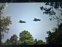
1420L- NOBLE 21 flights checking in ZNY 290.2, guessing F15's from Barnes since they're coming and going this way?
You are using an out of date browser. It may not display this or other websites correctly.
You should upgrade or use an alternative browser.
You should upgrade or use an alternative browser.
Mid-Atlantic MilAir 2024
- Thread starter Dutchmil
- Start date
-
- Tags
- milair milcom military air
- Status
- Not open for further replies.
I see your point - not sure but will search for an answerI apologize, I meant like program in the sense of, this is how we have established to do things, maybe "system" is a better word.
Are there systems set up make it clear that the average height of low level missions can never go below 200 feet, or is it made clear that at no point can it go below 200 feet (except in the appropriate classes of airspace, obviously).
Terrain following radar operations, I believe, use the average altitude of the aircraft.
I still have to wonder if pilots are taught that their average altitude doesn't count when at very low level.
For example, are the told that It doesn't matter if they are terrain following, when they cross a ridge they still have to be more than 200 ft above the TOP of the ridge".
Thanks
Joel
Seems Potus to Milwaukee Tuesday morning TFR and Philly Tuesday late afternoon.
Will see if the MA F-15C's continue CAP work...
An HC-130J #09-5707 inbound North Carolina Hickory airport KHKY tonight from DM Arizona 79th RQS.
Will see if the MA F-15C's continue CAP work...
An HC-130J #09-5707 inbound North Carolina Hickory airport KHKY tonight from DM Arizona 79th RQS.
Last edited:
Seems Potus to Milwaukee Tuesday..
Appears Philadelphia and Milwaukee Tuesday, before heading to Berlin for three days, then the Summit of the Ukraine Defense Contact Group at Ramstein Air Base, in Germany, on the way to Angola for two days.
freqhopping
Member
- Joined
- Jan 5, 2004
- Messages
- 7,111
- Reaction score
- 3,680
This is from the Dept of Energy, but likely the same for DOD. A key thing being that low-level flying is only done in very well-charted areas and any potential obstacles are known.
Altitude Considerations.
(1) Routine Training and Operations.
(a) Daylight Operations. Aircraft shall maintain a minimum
altitude of 200 feet above any known obstacle within 500
feet either side of the planned route of flight during
daylight operations except for takeoff, approach, and
landing.
(b) Night and Night Vision Goggle Operations. Except for
takeoff, approach, and landing, aircraft shall maintain a
minimum altitude of 500 feet above ground level or 200
feet above the highest obstacle within 1,000 feet either
side of the planned flight route, whichever is higher.
When using night vision goggles, aircraft shall maintain
a minimum altitude of 300 feet above ground level or 200
feet above the highest obstacle within 1,000 feet of the
planned route of flight, whichever is higher.
(2) Hazard Mapping. Each aircraft shall be equipped with a map
displaying all identifiable hazards to flight within the
operating area. A map displaying all identifiable hazards to
flight and depicting elevation above ground level shall be
conspicuously posted in the mission planning area. Aircraft
maps and mission planning area maps shall be reviewed for
currency at least every 30 days and marked with the current
date.
h. Terrain Flight (Nap of the Earth, Contour and Low Level). There
are three modes of terrain flight: contour, low level, and nap, of
the earth. Terrain flight is flight at 200 feet or less above the
highest obstacle on the intended flight path. Terrain flight and
night vision device/goggle flight are essential to DOE tactical and
security needs. Low level or, contour flight may provide a
tactical advantage in a security emergency. Nap of the earth
flight is not essential to the Department's security needs and will
not be performed.
(1) Contour flight conforms with the contours of the earth and is
characterized by varying airspeeds and altitudes. Contour
flight altitudes are not less than 25 feet above the highest
obstacle.
(2) Low level flight is not less than 100 feet above the highest
obstacle. It is conducted at a selected altitude and
generally conforms to a predetermined course, with constant
airspeed.
(3) Nap of the earth flight is characterized by maneuvers as close
to the earth's surface as vegetation, obstacles, or ambient
light will permit.
i. Training Route(s)/Areas.
(1) Low level and contour flight for training and proficiency
shall be conducted only over designated training routes or in
designated training areas.
(2) A low level flight route/area for training shall be developed
at each site. The training route(s)/area should be clear of
hazardous obstacles. The training route(s)/area and
associated altitude minimums shall be approved by each site
Federal Aviation Safety Officer, Contractor Aviation Manager/
Director of Flight Operations, and the Field Element
Safeguards and Security Director.
(3) The training route(s)/area(s) shall be clearly marked on each
aircraft map and mission planning map. A master map showing
all hazards to flight shall be conspicuously displayed for the
flight crews use.
VP travels to NYC on Monday, where she stays until Wednesday, when she goes to Las Vegas. On Thursday she heads to Arizona where she remains overnight, before she returns to DC on Friday.
At 5:00PM ET, the Vice President will depart Washington, DC en route to New York, NY.
At 5:55 PM ET, the Vice President will arrive in New York, NY, with arrival at LaGuardia Airport.
At 5:00PM ET, the Vice President will depart Washington, DC en route to New York, NY.
At 5:55 PM ET, the Vice President will arrive in New York, NY, with arrival at LaGuardia Airport.
Thanks for all of the research / Data, very informative and helpful.This is from the Dept of Energy, but likely the same for DOD. A key thing being that low-level flying is only done in very well-charted areas and any potential obstacles are known.
Altitude Considerations.
(1) Routine Training and Operations.
(a) Daylight Operations. Aircraft shall maintain a minimum
altitude of 200 feet above any known obstacle within 500
feet either side of the planned route of flight during
daylight operations except for takeoff, approach, and
landing.
(b) Night and Night Vision Goggle Operations. Except for
takeoff, approach, and landing, aircraft shall maintain a
minimum altitude of 500 feet above ground level or 200
feet above the highest obstacle within 1,000 feet either
side of the planned flight route, whichever is higher.
When using night vision goggles, aircraft shall maintain
a minimum altitude of 300 feet above ground level or 200
feet above the highest obstacle within 1,000 feet of the
planned route of flight, whichever is higher.
(2) Hazard Mapping. Each aircraft shall be equipped with a map
displaying all identifiable hazards to flight within the
operating area. A map displaying all identifiable hazards to
flight and depicting elevation above ground level shall be
conspicuously posted in the mission planning area. Aircraft
maps and mission planning area maps shall be reviewed for
currency at least every 30 days and marked with the current
date.
h. Terrain Flight (Nap of the Earth, Contour and Low Level). There
are three modes of terrain flight: contour, low level, and nap, of
the earth. Terrain flight is flight at 200 feet or less above the
highest obstacle on the intended flight path. Terrain flight and
night vision device/goggle flight are essential to DOE tactical and
security needs. Low level or, contour flight may provide a
tactical advantage in a security emergency. Nap of the earth
flight is not essential to the Department's security needs and will
not be performed.
(1) Contour flight conforms with the contours of the earth and is
characterized by varying airspeeds and altitudes. Contour
flight altitudes are not less than 25 feet above the highest
obstacle.
(2) Low level flight is not less than 100 feet above the highest
obstacle. It is conducted at a selected altitude and
generally conforms to a predetermined course, with constant
airspeed.
(3) Nap of the earth flight is characterized by maneuvers as close
to the earth's surface as vegetation, obstacles, or ambient
light will permit.
i. Training Route(s)/Areas.
(1) Low level and contour flight for training and proficiency
shall be conducted only over designated training routes or in
designated training areas.
(2) A low level flight route/area for training shall be developed
at each site. The training route(s)/area should be clear of
hazardous obstacles. The training route(s)/area and
associated altitude minimums shall be approved by each site
Federal Aviation Safety Officer, Contractor Aviation Manager/
Director of Flight Operations, and the Field Element
Safeguards and Security Director.
(3) The training route(s)/area(s) shall be clearly marked on each
aircraft map and mission planning map. A master map showing
all hazards to flight shall be conspicuously displayed for the
flight crews use.
The minimum heights, are they above instantaneous terrain, or is it thought of as height above average terrain?
The reason I ask is I've always gotten the impression of low level penetration flights using average terrain height.
and the most important
As far as known obstacles, do they (you know "them") know that a person doesn't have to notify anyone about ( or light) a tower less than 200 feet mounted next to an outbuilding ( as in it wont show up on a chart ), even on a ridge top (with obvious exceptions) ?
Terrain flight as mentioned above, could be a problem, unless it is ONLY done above terrain that is protected from having towers on them.
This is why I am thinking about programs / systems possibly not meshing well in this regard.
Thanks
Joel
BM82557
Member
There go Patrick AFB HC-130Js Kings evacuating to northwest to Little Rock.
Last edited:
mdmonitor
Member
MarkThere go Patrick AFB HC-130Js Kings evacuating to northwest.
Looks like the NAS JAX P-8s are getting out of the way too
mdmonitor
Member
0925- 7th FTS T-38s busy today. Hover (2) in Evers MOA & Dude (2), Swamp (4) in W386 w/Rumble flt (F-22s). Freqs: 238.1/236.55/255.65/292.3
Last edited:
mdmonitor
Member
1010- Some 71st FS F-22s (Knight) were also part of the W386 activity earlier. Freq: 227.2/274.2
At 14:30 state of play......TABOR 71 and TABOR 81 flight were working Atlanta center this afternoon and then
switched to Washington center on 322.450. Still scheduled into EGUL tomorrow ....
Gold 21(46023)
Gold 22(91476)
Tabor72-76. ETA Lakenheath 17:00L
Gold 31(46049)
Gold 32(38879)
Tabor81/83-85. ETA Lakenheath 18:00L
mdmonitor
Member
1130- Vinyl 92 (KC-46 # 19-46057) inbound to McGuire from the west. Working Brickyard CP (237.15).
apex31
Active Member
- Joined
- Feb 3, 2024
- Messages
- 568
- Reaction score
- 2,746
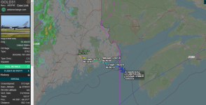
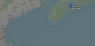
They were part of the tanker chain which brought “MO” F-15E’s from Seymour-Johnson to Lakenheath earlier this morning.Are there anymore flights across the pond? just noticed these two KC-135's out of Bangor.
View attachment 170380
Tankers involved:
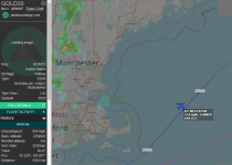
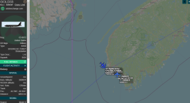
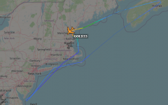
Pease - KC-135s (57-2598, 63-8012) each picked up (six?) F-15s off the coast of Rehoboth Beach and dumped them over Nova Scotia to KC-135s and KC-46s out of Bangor.
Bangor - KC-46s (16-46023, 18-46049) and KC-135s (59-1476, 63-8879) brought the F-15s from Nova Scotia airspace to Lakenheath.
Last edited:
These tanker's have only just touched down at Bangor, the F-15E's had already touched down in the UK at Lakenheath, Just seems strange the time difference.They were part of the tanker chain which brought “MO” F-15E’s from Seymour-Johnson to Lakenheath earlier this morning.
Tankers involved:
Pease - KC-135s (57-2598, 63-8012) each picked up (six?) F-15s off the coast of Rehoboth Beach and dumped them over Nova Scotia to KC-135s and KC-46s out of Bangor.
Bangor - KC-46s (16-46023, 18-46049) and KC-135s (59-1476, 63-8879) brought the F-15s from Nova Scotia airspace to Lakenheath.
Gold 21(46023)
Gold 22(91476)
Tabor72-76. ETA Lakenheath 17:00L. Landing order at Lakenheath, was Tabor73/72/74/76 (17:14-15)
90-0245 Tiger
88-1667 T-bolt
87-0210 T-bolt
87-0183 T-bolt
Gold 31(46049)
Gold 32(38879)
Tabor81/83-85. ETA Lakenheath 18:00L. Tabor81 landing order, 81/83/85/84 (18:01-02)
Tabor81/83/85/84 were 70198/0182/0173/0202
Fighter Control reported TABOR82 & TABOR86 had issues and returned to Seymour Johnson.
mdmonitor
Member
1515- Score 61 (KC-130 # 163310 VX-20) out in Test Track working w/unid acft. Using VX-20 test discrete (267.0).
- Status
- Not open for further replies.
Similar threads
- Replies
- 21
- Views
- 3K
- Locked
- Replies
- 0
- Views
- 1K


